HomeAuto Sentinel-4 Operational: Europe Closes First Continuous Three-Continent Pollution Monitoring Ring
Sentinel-4 Operational: Europe Closes First Continuous Three-Continent Pollution Monitoring Ring
September 29, 2026:
Eumetsat.int
Europe’s new air-quality satellite went fully operational Monday, completing the first planetary network of geostationary pollution monitors — one that can now watch the same plume of nitrogen dioxide, wildfire smoke, or volcanic sulfur drift from Asia to Europe to North America over the course of a single day. For more than 450 million Europeans, that means air-quality forecasts now draw on something that simply did not exist before: a continuous, hourly satellite view of the atmosphere above their cities.
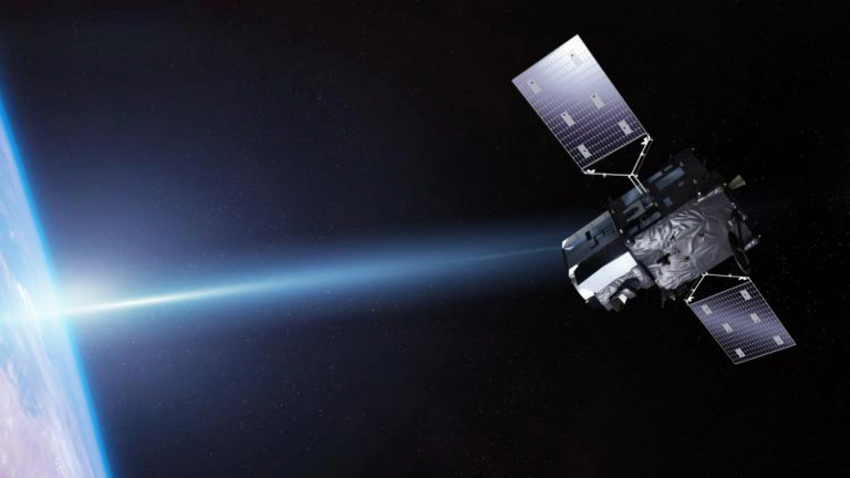
The European Organisation for the Exploitation of Meteorological Satellites (EUMETSAT) today formally assumed operational control of the Copernicus Sentinel-4 instrument, the ultraviolet, visible, and near-infrared spectrometer aboard the Meteosat Third Generation Sounder 1 satellite (now officially redesignated Meteosat-13). The declaration closes a chapter that began with a contract signed in 2011, reached an early milestone with the July 2025 Florida launch atop a SpaceX Falcon 9 from Kennedy Space Center, and concluded with the Steering Committee of the Commissioning Results Review officially certifying commissioning completion on July 2, 2026.
How Sentinel-4 Reads the Air: Spectral Fingerprints from 22,000 Miles Up
The instrument at the heart of this milestone is a UV-Vis-NIR (ultraviolet, visible, near-infrared) imaging spectrometer measuring reflected sunlight from Earth’s surface and atmosphere. Every molecule in the atmosphere absorbs light at specific wavelengths — nitrogen dioxide, ozone, sulfur dioxide, formaldehyde, and the organic compound glyoxal each leave a distinctive narrow-band “fingerprint” when sunlight passes through them. Sentinel-4 reads those fingerprints using a technique called Differential Optical Absorption Spectroscopy (DOAS), which separates the narrow molecular absorption features from the broad, diffuse scattering caused by aerosols and air molecules.
The spectrometer covers three spectral bands: ultraviolet, visible, near-infrared — specifically 305–400 nm, 400–500 nm, and 750–775 nm. These ranges were chosen because each target pollutant absorbs most strongly in a different portion of the spectrum — ozone’s signature sits primarily in the UV, nitrogen dioxide peaks in the visible blue-green range, and the near-IR band captures aerosol properties that help characterize particulate matter. The result is a spatial sampling resolution of roughly 8-km-square pixels — 8 km × 8 km (5 miles × 5 miles), sufficient to distinguish whether the brown haze sitting over Milan originates in the Po Valley’s industrial corridor or drifts in from outside the region.
Why Hourly Matters: Pollutants That Live and Die with the Sun
The reason an instrument like Sentinel-4 needs to be geostationary — not polar-orbiting like its predecessor Sentinel-5P — is photochemistry. Nitrogen dioxide itself is emitted directly from vehicle exhausts and power plants. But ground-level ozone and formaldehyde are not emitted; they are manufactured in the atmosphere by photochemical reactions between sunlight, nitrogen oxides, and hydrocarbons. These reactions begin at sunrise, accelerate through the midday UV peak, and wind down as evening approaches.
A polar satellite in low Earth orbit passes over a given European city once every 24 hours — typically in mid-morning. That single daily snapshot misses the afternoon ozone peak almost entirely, and captures none of the evening chemistry as fresh traffic emissions change the pollutant mix again. The prior Copernicus air-quality missions produced only a single image of Europe per day, meaning the daily pollution arc was invisible to satellites. Sentinel-4, positioned at 0° longitude in geostationary orbit at 35,786 kilometers (22,236 miles) above the equator, stares continuously at Europe and part of North Africa throughout all daylight hours — delivering a fresh image hourly. This temporal resolution resolves the full photochemical cycle: morning traffic spike in NO₂, midday ozone buildup, afternoon smog accumulation in downwind suburbs, evening chemistry reset. The difference is not operational convenience; it is a scientifically irreducible capability gap that geostationary orbit is the only architecture that can close.
“Hourly observations of these hazardous pollutants over the whole of Europe have never been possible before,” said Lieven Bydekerke, EUMETSAT’s Copernicus Program Manager.
What Is the Geo-Ring, and Why Does Europe’s Piece Matter?
Sentinel-4 does not operate in isolation. Since at least 2020, atmospheric scientists have been building toward a “Geo-Ring” — a coordinated constellation of geostationary UV-visible spectrometers covering the populated Northern Hemisphere in overlapping, continuous air-quality watches.
South Korea’s Geostationary Environment Monitoring Spectrometer (GEMS), launched in February 2020 aboard the GEO-KOMPSAT-2B satellite, covers Asia from geostationary orbit. NASA’s Tropospheric Emissions: Monitoring of Pollution (TEMPO) instrument, launched in April 2023 aboard the commercial satellite Intelsat 40E at a geostationary orbit roughly 35,400 kilometers (22,000 miles) above Earth’s equator, covers North America coast to coast from the Atlantic to the Pacific and from central Canada to Mexico City. TEMPO became the first space-based hourly pollution monitor to measure atmospheric gases affecting air quality across the North American continent during daylight hours at high spatial resolution.
With Sentinel-4 now declared operational, the three-node ring is complete. For the first time in history, a pollution plume originating from a factory in eastern China can be tracked through its chemical transformation as it crosses the Pacific (outside any single instrument’s coverage), arrives over North America where TEMPO logs it, dissipates or re-concentrates, and eventually any remnant chemistry crosses the Atlantic and appears in Sentinel-4’s European view — all within the span of days and all during daylight hours, continuously. For researchers studying transboundary pollution episodes from wildfire seasons in Siberia, volcanic eruptions in Iceland, or Saharan dust storms tracking northwest over the Mediterranean, completing the Geo-Ring constellation eliminates the daily satellite blackout that previously made continental-scale tracking impossible.
Sentinel-4 can detect rapid pollution changes caused by rush-hour traffic, industrial emissions, and even transboundary events like Saharan dust storms and wildfire smoke.
One Satellite, Two Missions: How the Hosted-Payload Architecture Works
Sentinel-4 is not a standalone spacecraft. The UVN spectrometer is a hosted payload aboard EUMETSAT’s MTG-S1 (Meteosat-13), which also carries the Infrared Sounder (IRS) — Europe’s first geostationary hyperspectral sounder. The IRS measures vertical profiles of atmospheric temperature and humidity every 30 minutes, feeding improved severe-weather forecasts to national meteorological services.
The “one satellite, two missions” architecture was an economic and scientific design choice: hosting two instruments on a single platform reduces cost compared to launching separate satellites, and the simultaneous measurements of atmospheric chemistry (Sentinel-4) and atmospheric dynamics (IRS) together produce something neither instrument could generate alone. When a thunderstorm or temperature inversion traps pollution near ground level, the IRS simultaneously shows why — the layered structure of the atmosphere that is preventing pollutants from dispersing — while Sentinel-4 shows what is accumulating.
The data pipeline from Sentinel-4 flows through EUMETSAT’s Level-1B and Level-2 processors, which convert the raw spectra into trace-gas column amounts, and then into the Copernicus Atmosphere Monitoring Service (CAMS), operated by ECMWF in Reading, UK. CAMS already delivers hourly air quality data over Europe using advanced atmospheric models; Sentinel-4’s direct satellite observation will now be assimilated into CAMS forecasts to improve their accuracy. All data is available free of charge through the Copernicus Atmosphere Data Store.
Phil Evans, Director-General of EUMETSAT, described the stakes: “Exposure to pollutants such as nitrogen dioxide, ground-level ozone, and fine particulate matter affects millions of Europeans every day, costing society hundreds of billions of euros annually. Copernicus Sentinel-4 represents a fundamental advance in our ability to monitor these pollutants.”
Is Hourly Pollution Data Enough to Clean Europe’s Air?
The health stakes that Sentinel-4 addresses are substantial. According to the European Environment Agency’s 2024 burden-of-disease report, air pollution caused 416,000 premature deaths in 2022 — with 239,000 attributable to fine particulate matter exposure in EU member states alone. The EEA classifies air pollution as Europe’s largest environmental health risk, one that significantly impacts the health of the European population, particularly in urban areas.
Sentinel-4 data supports the revised EU air quality directive (EU/2024/2881), published in November 2024, which introduces 2030 standards closer to World Health Organization recommendations. The instrument’s hourly data can do something ground-based monitoring networks cannot: catch industrial emitters exceeding permitted levels on a specific hour of a specific day, not just show that annual averages in a region are too high. For regulatory enforcement, that distinction matters enormously.
There is one caveat worth noting: cloud cover masks readings. When clouds lie between Sentinel-4 and the ground, the spectrometer cannot retrieve reliable surface-level pollutant concentrations beneath them — the October 2025 first images specifically noted cloud masking in the initial maps. Over persistently cloud-covered regions or during overcast winter periods, Sentinel-4 data will be sparser. Ground-based monitoring networks and polar-orbit satellites like the existing Sentinel-5P remain necessary complements.
What Comes Next for the MTG Constellation
Sentinel-4 is one of two air-quality instruments EUMETSAT will operate under the Copernicus program. A second instrument, Sentinel-4B, will fly on MTG-S2, scheduled to launch in the mid-2030s, ensuring geostationary monitoring continuity into the 2040s.
The overall Meteosat Third Generation system commissioning — which includes instruments beyond Sentinel-4 — is planned for completion by October 2026. MTG-I2, the third satellite in the MTG constellation, was launched on August 27, 2026 and is undergoing its commissioning phase, with operational service expected in Q2 2027. Once operational, MTG-I2 will add the Rapid Scanning Service — updating Europe every 2.5 minutes instead of every 15 minutes — completing the full MTG constellation’s observational capability.
Richard Engelen, Deputy Director of CAMS, described Sentinel-4’s potential: “They will allow us to implement some of the most important and challenging products and services in the near future such as emissions monitoring capabilities, not just for greenhouse gases but also for some of the air pollutants regulated by the European legislation.”
Frequently Asked Questions
What is the Geo-Ring, and is Sentinel-4 really the last piece?
The Geo-Ring is an informal name for the coordinated set of geostationary UV-visible spectrometers that together cover the Northern Hemisphere’s populated latitudes during daylight hours: South Korea’s GEMS over Asia (since 2020), NASA’s TEMPO over North America (since 2023), and now Europe’s Sentinel-4 (declared operational today). The three instruments were designed and calibrated to be scientifically consistent, meaning researchers can compare measurements across the three nodes. Sentinel-4 is indeed the final node needed to make the Geo-Ring complete — before today, there was no continuous geostationary air-quality coverage over Europe during the day.
How does Sentinel-4 measure pollution from 22,000 miles away?
Sentinel-4’s UV-Vis-NIR spectrometer detects how much sunlight — reflected back from Earth’s surface and atmosphere — has been absorbed at specific wavelengths before reaching the instrument. Each pollutant molecule absorbs light at characteristic wavelengths (its spectral “fingerprint”). Nitrogen dioxide absorbs in the visible blue-green range, ozone in the ultraviolet, sulfur dioxide in the UV as well. By mathematically removing the broad scattering effects of air and aerosols (using a technique called Differential Optical Absorption Spectroscopy, or DOAS), scientists can isolate the narrow fingerprints of each gas and calculate its concentration in a vertical column of atmosphere below the satellite.
How will air quality apps and health services actually use this data?
Sentinel-4 data flows into the Copernicus Atmosphere Monitoring Service (CAMS), operated by the European Centre for Medium-Range Weather Forecasts (ECMWF). CAMS produces hourly air quality forecasts for Europe that are already used by national health authorities to issue pollution alerts and by urban planning bodies to study traffic-emission patterns. Adding direct geostationary satellite observations to CAMS’s existing model-based forecasts will improve their accuracy — particularly for detecting sudden pollution events like industrial accidents, volcanic eruptions, or long-range transport of wildfire smoke from Siberia or Canada. The data is freely and openly available through the Copernicus Atmosphere Data Store.
Can Sentinel-4 detect my city’s pollution specifically?
At 8 km × 8 km (about 5 miles × 5 miles) per pixel, Sentinel-4 can distinguish pollution differences between a city center and its surrounding countryside, or track an industrial plume as it drifts downwind. It cannot resolve individual streets or identify a specific factory as a point source. For sub-city-level attribution, ground-based sensor networks remain essential. Where Sentinel-4 adds irreplaceable value is in the temporal dimension: it shows how pollution levels across an entire country or region change hour by hour through the day, something no ground network and no polar-orbit satellite can provide.