HomeAuto Japan Earthquake Early Warning Rang 37 Million Tokyo Phones Before Ibaraki Shaking Hit
Japan Earthquake Early Warning Rang 37 Million Tokyo Phones Before Ibaraki Shaking Hit
August 24, 2026:
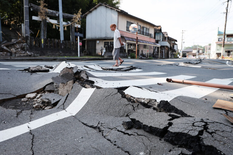
A man walks along a destroyed road in Uki, Kumamoto prefecture on August 3, 2026, following the July 28 earthquake. JIJI PRESS/AFP via Getty Images
Before the most damaging waves from a magnitude 5.9 earthquake reached metropolitan Tokyo early Sunday morning, every cell phone in the city was already screaming. The Japan Meteorological Agency’s (JMA) earthquake early-warning network — 4,235 seismometers wired together into the world’s most sophisticated seismic alert system — detected the incoming threat, computed the trajectory of the destructive shaking, and pushed a simultaneous alarm to tens of millions of devices before the S-waves arrived. For most residents in a 37-million-person metro area that was asleep at 2:00 a.m. local time, those seconds of advance notice are what the system was built for.
The quake, which the JMA assigned a preliminary magnitude of 5.9 and the U.S. Geological Survey independently measured at 5.8, struck in southern Ibaraki Prefecture at a depth of approximately 70 kilometers (about 43 miles). At least 37 people were injured across five prefectures — 15 in Tokyo, nine in Saitama, eight in Kanagawa, four in Chiba, and one in Ibaraki — according to Japan’s Fire and Disaster Management Agency, with most injuries caused by disoriented residents falling out of bed or colliding with furniture in the darkness. The most serious case involved an elderly woman in her 80s who suffered a hip injury after falling from her bed in Yokohama, in Kanagawa Prefecture. No deaths were reported. JMA officials said there was no risk of a tsunami.
What the Early Warning System Actually Did
The alert that rang across Tokyo on Sunday was not a text message, and it was not routed through Japan’s equivalent of a 911 center. It was a Cell Broadcast — a transmission architecture that is fundamentally different from ordinary SMS. Where a conventional text message addresses a single recipient and travels through the carrier’s messaging infrastructure one by one, a Cell Broadcast packet simultaneously pushes to every device registered on every cell tower in a defined geographic zone. No individual addressing. No delivery queue. No congestion. Every phone rang at nearly the same instant.
Japan’s major carriers — NTT Docomo, au (KDDI), and SoftBank — developed their Cell Broadcast earthquake-alert capability starting in 2007 and 2008. Since then, the JMA has used it to push alerts for thousands of seismic events. It is enabled by default on all compatible handsets and bypasses silent mode. Tourists with foreign phones on Japanese carrier roaming receive it as well, as do iPhones running iOS 5 or later.
The physics behind the timing advantage is straightforward. Earthquakes generate two primary wave types that travel through the Earth at different speeds. P-waves (primary waves) compress and expand material in the direction they travel and move at roughly 4 to 7 kilometers per second (about 2.5 to 4.3 miles per second) — they are detectable by seismometers but produce little destructive ground motion. S-waves (secondary, or shear, waves) travel at roughly half P-wave speed — roughly 2 to 4 kilometers per second (about 1.2 to 2.5 miles per second) — and cause the lateral, side-to-side motion that injures people, topples objects, and stresses structures. The gap between when the P-wave arrives at a sensor and when the S-wave arrives at a distant population center is the warning window. For a city 100 kilometers (62 miles) from an epicenter, that window can be 10 to 20 seconds or more — enough time to take cover, for trains to begin emergency braking, and for factory equipment to halt automatically.
Sunday’s earthquake placed its epicenter in Ibaraki — relatively close to the Tokyo metro area — at a depth of 70 km (43 miles). The combination of moderate distance and significant depth meant residents in Saitama, Kanagawa, and Chiba received meaningful lead time before the strongest shaking reached them. The deep focal depth — classifying this as an intraslab event within the subducting Pacific Plate, rather than a shallower crustal fracture — also explains both the wide geographic reach of the shaking and the absence of tsunami risk: deep intraslab ruptures do not displace the ocean floor in the way that shallow megathrust events do.
Why the System Has a Fundamental Blind Zone
The alert did not reach everyone in time. Near the epicenter itself — and always, for any earthquake early-warning system — the P-wave and S-wave arrive almost simultaneously. The system cannot warn someone who is standing directly above the rupture. For Sunday’s event, this meant residents in southern Ibaraki closest to the epicenter received little or no advance notice; the rest of the Kanto region benefited from the network’s reach.
Research published in the International Journal of Disaster Risk Reduction (April 2024) by Professor Kazuya Nakayachi of Doshisha University’s Faculty of Psychology found an additional human-factors limitation: only about 34 percent of people who received a JMA EEW mobile alert took immediate protective action as their first response. The majority paused to assess the situation before acting. Sunday’s injury pattern — most victims fell while scrambling out of bed in confusion — is consistent with that finding. The early-warning system works best when recipients have internalized the response behavior in advance through drills.
Since its launch in October 2007, the JMA has continuously refined the system’s algorithms. The Integrated Particle Filter (IPF) method, introduced in December 2016, improved the ability to distinguish simultaneous earthquakes — a documented failure mode that had produced false alarms in which multiple small events were read as a single large one. The Propagation of Local Undamped Motion (PLUM) method, detailed in the 2021 Frontiers paper, added in March 2018, improved accuracy for very large or complex earthquakes by predicting intensity directly from observed shaking rather than back-calculating from an estimated source location. Ocean-floor sensors added via the S-NET network along the Japan Trench extended the system’s reach to offshore events, adding detection time for tsunamigenic quakes before P-waves even reach land.
What Happened on the Ground
Emergency earthquake alerts blared from mobile phones across the greater Tokyo metropolitan area at approximately 2:00 a.m. local time, waking millions of residents. NHK public television broadcast live footage from nearby cities including Mito and Saitama, where road traffic appeared normal shortly after the event.
An underground water pipe ruptured in Tokyo’s eastern ward of Koto, sending water onto a road — footage captured by NHK showed repair crews responding quickly; the leak was stopped later that morning. Power outages affected about 460 Tokyo homes, though TEPCO Power Grid confirmed electricity was restored to all affected customers by Sunday morning.
Express trains serving Tokyo and Narita Airport were delayed as a precautionary measure, but East Japan Railway Co. confirmed that the Shinkansen bullet-train network continued operating without interruption throughout the event. The railway’s automatic emergency-braking response — triggered by the same EEW system alert — is a documented life-safety mechanism: trains slow or stop automatically before strong shaking arrives, preventing derailments.
The Nuclear Regulation Authority reported no nuclear anomalies from approximately a dozen facilities across the region — a check that has become routine and legally mandated in Japan following the 2011 Fukushima crisis. Prime Minister Sanae Takaichi, who previously served as Minister for Internal Affairs and Communications (the ministry responsible for Japan’s telecommunications and broadcast regulatory framework, including the Cell Broadcast infrastructure the EEW system relies on), announced via X that the government had established a task force to assess damage.
Why Ibaraki Is Structurally Prone to Earthquakes
Sunday’s quake came from southern Ibaraki Prefecture — an area that sits directly above one of the most seismically active tectonic configurations on Earth. Japan lies at the intersection of four major tectonic plates: the Pacific, Philippine Sea, Eurasian, and North American plates. The Pacific Plate subducts beneath the overlying Okhotsk (North American) Plate along the Japan Trench at a rate of roughly 8 to 9 centimeters per year (about 3.1 to 3.5 inches per year) — one of the fastest subduction rates measured anywhere on Earth. That subduction process is what makes the Kanto and Tohoku regions persistently seismic: stress accumulates along the plate boundary and is periodically released as earthquakes of varying depths and magnitudes.
Sunday’s event at 70 km (43 miles) depth is classified as an intraslab earthquake — meaning the rupture occurred within the descending Pacific Plate rather than at the plate interface itself. Intraslab earthquakes tend to distribute shaking over a wide area (explaining why five prefectures reported injuries) while producing less violent surface motion than a shallower event of equivalent magnitude would. They also do not displace the seafloor in a way that generates tsunamis.
Japan has experienced three major seismic disasters that have shaped public understanding of earthquake risk in living memory: the 1995 Kobe earthquake (M6.9, more than 6,400 deaths), the 2011 Tohoku earthquake and tsunami (M9.0, nearly 20,000 deaths, Fukushima nuclear crisis), and the 2016 Kumamoto earthquake sequence. More recently, a magnitude 7.1 earthquake struck the Kumamoto area of Kyushu on July 28, 2026, killing at least 39 people and injuring more than 350 others, destroying more than 1,500 buildings and damaging nearly 20,000 others. That disaster prompted emergency telecom responses and kept earthquake preparedness at the front of public consciousness through August.
Does the US Have Anything Comparable?
Japan’s system is not the world’s only earthquake early-warning network, but it is the most mature and the most densely instrumented. The United States operates ShakeAlert, developed by the U.S. Geological Survey (USGS) in partnership with state and federal agencies, which covers California, Oregon, and Washington. Public alerting via Wireless Emergency Alert (WEA) began in California in 2019 and expanded to Oregon and Washington in 2021 — covering approximately 50 million people. Between October 2019 and September 2023, ShakeAlert sent 41 public alerts for qualifying earthquakes.
The architectural difference matters. Japan uses Cell Broadcast — a push technology that transmits to all devices in a cell tower’s coverage zone simultaneously, requiring no individual addressing and producing no network congestion. ShakeAlert uses Wireless Emergency Alerts, which are delivered through a different technical pathway that can be filtered or suppressed by users or carriers in ways Cell Broadcast is not. No equivalent nationwide earthquake early-warning system exists for the eastern United States, the Pacific Northwest’s Cascadia Subduction Zone beyond the covered states, or the New Madrid Seismic Zone (which last ruptured catastrophically in 1811-1812). Japan’s 4,235-sensor network has been refining its algorithms for eighteen years; the US system has fewer sensors and less operational history.
Aftershocks Remain Possible
Japanese seismological agencies continued monitoring the southern Ibaraki region for aftershocks following the main shock, as is standard protocol after any event in this magnitude range. Residents in the affected prefectures were advised to remain alert to continued seismic activity in the days following the main shock.
Sunday’s earthquake caused no major structural damage, no fatalities, and no nuclear safety incidents — a testament both to the depth of the quake and to the seismic engineering Japan has built into its infrastructure over decades. The system designed to give residents a few precious seconds of warning before the shaking arrived performed the function it was built for.
Frequently Asked Questions
How does Japan’s earthquake early-warning system deliver alerts to phones before shaking arrives?
When P-waves (the fast-moving but non-destructive first waves from an earthquake) reach two or more of Japan’s 4,235 seismometers, the JMA’s system analyzes the signal to estimate the epicenter’s location and magnitude. It then computes where destructive S-waves (the slower shear waves that cause structural damage) will arrive and how strong the shaking is expected to be at various distances. The resulting alert is transmitted via Cell Broadcast — a technology that pushes an identical message simultaneously to all cell phones registered on every tower in the affected geographic area, bypassing individual addressing and bypassing silent mode. The total process from P-wave detection to alert delivery takes roughly 2 to 3 seconds. People closer to the epicenter receive little or no lead time; people farther away may get 10 to 30 seconds or more.
Why was there no tsunami warning for Sunday’s earthquake?
Tsunamis require a sudden vertical displacement of the ocean floor — the kind that occurs during large, shallow megathrust earthquakes at or near the plate boundary interface. Sunday’s M5.9 quake was an intraslab event: a rupture within the subducting Pacific Plate at a depth of approximately 70 km (43 miles). At that depth, the rupture’s energy was absorbed and distributed through the overlying rock before it could displace the seafloor sufficiently to generate a tsunami wave. JMA seismologists make this assessment in near-real-time, typically issuing or canceling a tsunami warning within minutes of the initial event.
Does the United States have an earthquake early-warning system like Japan’s?
The US operates ShakeAlert on the West Coast — covering California, Oregon, and Washington (approximately 50 million people) via Wireless Emergency Alerts since 2019-2021. ShakeAlert uses a different delivery architecture from Japan’s Cell Broadcast system and has fewer seismometers and less operational history. No equivalent public earthquake early-warning system exists for the eastern United States, including the New Madrid Seismic Zone or the Atlantic coastal regions. Japan’s EEW network has operated since October 2007 and currently runs 4,235 seismometers — a significantly denser sensor network than what currently covers any US region.
Why does Ibaraki Prefecture experience so many earthquakes?
Ibaraki Prefecture in the Kanto region sits directly above the boundary where the Pacific Plate subducts beneath the North American (Okhotsk) Plate along the Japan Trench. The Pacific Plate drives northwest at approximately 8 to 9 centimeters per year (about 3.1 to 3.5 inches per year), one of the fastest subduction rates on Earth. That constant plate motion continuously accumulates stress along the boundary and within the descending slab itself, producing frequent earthquakes at a range of depths. Deep events like Sunday’s (70 km below the surface) are felt widely but tend to cause less surface damage than shallow crustal earthquakes of equivalent magnitude.