HomeAuto India Monsoon 2026 Ends With Worst Deficit in Over Decade, IMD Confirms
India Monsoon 2026 Ends With Worst Deficit in Over Decade, IMD Confirms
October 1, 2026:
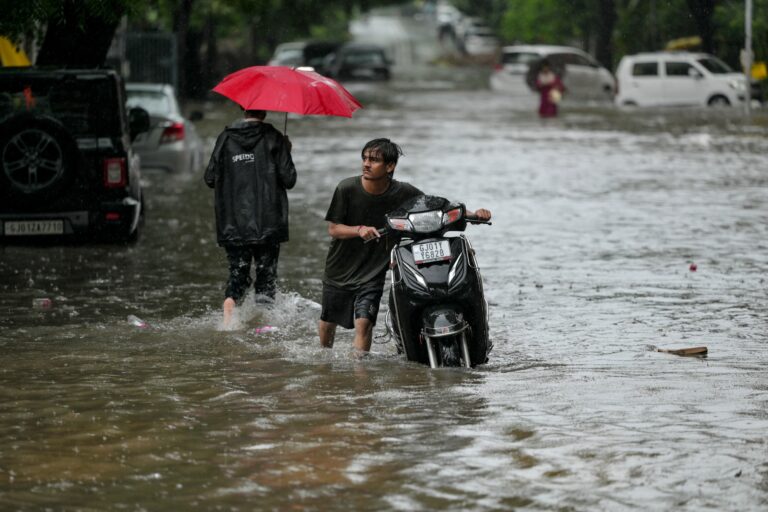
A man pushes his scooter through a water-logged street during rainfall in Ahmedabad on September 14, 2026. Shammi MEHRA/GettyImages.com
India’s southwest monsoon closed its books on September 30 as the weakest in more than a decade, with the India Meteorological Department (IMD) officially confirming a full-season rainfall total of 759 mm (29.9 inches) against a long-period average (LPA) of 868.6 mm (34.2 inches) — a shortfall of roughly 13 percent, making 2026 the weakest monsoon since 2015. Drought conditions are now active in Karnataka, Maharashtra, and parts of Andhra Pradesh, Telangana, and Rajasthan, with the government having cut its 2026–27 national foodgrain production target in direct response.
The season turned difficult from its first day. June 2026 delivered only 99.5 mm (3.9 inches) of rainfall — 39.8 percent below the monthly normal of 165.3 mm (6.5 inches) — earning the distinction of the fifth-driest June since India’s rainfall records began in 1901. Only four calendar years in that 125-year span recorded a drier June: 2009, 1905, 2014, and 1926. The southwest monsoon reached Kerala three days behind schedule on June 4, then stalled across western farming regions for roughly two weeks, deepening the early-season hole before rains could even begin irrigating freshly sown fields. All of this is documented in SANDRP’s June–August district analysis, published September 8.
July Offered Hope; August and September Did Not
July reversed the trajectory briefly. The country received 290.3 mm (11.4 inches) against a normal of 280.5 mm (11.0 inches) — a modest 3.5 percent surplus — but that surplus proved too shallow and too narrowly distributed to compensate for the catastrophic June opening. August then fell back into deficit, delivering 213.9 mm (8.4 inches) against a normal August figure of 254.9 mm (10.0 inches), a gap of 16.1 percent. August also turned into India’s warmest August since 1901, with a mean temperature of 28.01°C (82.4°F), a marker of the heat stress that compounds drought in an already difficult growing season.
The month-by-month picture tells a season of two swings and one missed recovery:
Month
Actual
Normal
Deviation
June 2026
99.5 mm (3.9 in)
165.3 mm (6.5 in)
–39.8%
July 2026
290.3 mm (11.4 in)
280.5 mm (11.0 in)
+3.5%
August 2026
213.9 mm (8.4 in)
254.9 mm (10.0 in)
–16.1%
June–Aug
603.7 mm (23.8 in)
700.7 mm (27.6 in)
–13.8%
Full Season
759 mm (29.9 in)
868.6 mm (34.2 in)
~–13%
Almost No Region Escaped: How the Deficit Spread Across India
The season’s damage was not localized. According to the district-level analysis published September 8 by the South Asia Network on Dams, Rivers and People (SANDRP), which draws on IMD’s state and sub-divisional data, the June–August period left 14 states and Union Territories with 20 to 59 percent rainfall deficits. Only one state — Ladakh, a high-altitude desert region — recorded large-excess rainfall, posting a 195 percent surplus above its tiny baseline of 49.2 mm (1.9 inches). The highest absolute rainfall in the country during June–August landed in Diu-Daman-Dadra-Nagar Haveli at 2,735.3 mm (107.7 inches), while the worst absolute total was Rayalseema in Andhra Pradesh at just 154.8 mm (6.1 inches).
Of IMD’s 36 meteorological subdivisions, 17 recorded deficit conditions across the three-month period. Not one recorded large-excess rainfall. Rayalseema posted the worst sub-divisional shortfall at 43 percent below normal. For the full season, East and Northeast India emerged as the hardest-hit region: it received 1,017.1 mm (40.0 inches) against a normal of 1,367.3 mm (53.8 inches) — a deficit of 26 percent. South Peninsular India followed at 24 percent below normal (542 mm, or 21.3 inches, against a normal of 716.2 mm, or 28.2 inches), while Northwest India ran 6 percent short and Central India managed a relatively small 3 percent deficit. These regional breakdowns are confirmed in IMD’s official end-of-season data.
Skymet Weather Services, India’s largest private weather forecaster, had already placed nationwide drought probability at 70 percent by mid-August — a 7-in-10 call that the full-season figures now bear out.
How El Niño Silences the Monsoon: the Walker Circulation at Work
The 2026 season’s failure was anticipated. The mechanism is one of the most studied teleconnections in climate science: El Niño, the periodic warming of the central and eastern equatorial Pacific Ocean, disrupts a large-scale atmospheric engine called the Walker Circulation.
Under normal conditions, warm water in the western Pacific drives powerful convective columns of rising, moisture-laden air. Trade winds blow westward along the ocean surface, reinforcing the warm pool. The rising air fuels the cloud systems that ultimately seed the monsoon. When El Niño arrives, sea-surface temperatures in the central and eastern Pacific rise anomalously — sometimes by 2 to 3°C (3.6 to 5.4°F) — shifting the epicenter of atmospheric convection eastward. The sinking, dry branch of the Walker Circulation migrates with it, parking descending air over the Maritime Continent and, critically, over the Indian Ocean and Indian subcontinent. That descending air suppresses the deep convection that fuels monsoon rainfall. It weakens the cross-equatorial moisture flow feeding the monsoon trough. It shifts the trough northward and reduces the number and intensity of the low-pressure systems that track along it — the very systems that deliver rainfall to farming regions.
India’s own weather agency noted strong El Niño Pacific conditions prevailing through the monsoon season, with sea surface temperature anomalies above normal across the central and eastern Pacific.
The US National Oceanic and Atmospheric Administration (NOAA) had flagged an 82 percent El Niño probability for the May–July 2026 window, rising to 96 percent by winter. Climate models at that stage indicated elevated probability that the event could reach strong or very strong intensity by late 2026 — which would make it among the most intense events since 1950.
A second atmospheric variable — the Indian Ocean Dipole (IOD), which measures the temperature contrast between the western and eastern Indian Ocean — can partially buffer El Niño’s impact when it turns positive. The record shows the 1997 El Niño, one of the strongest ever recorded, produced no drought in India precisely because a concurrent strong positive IOD offset the Pacific disruption. In 2026, the IOD was neutral through most of the season and only began transitioning toward positive conditions in late September — too late to prevent the damage that had already accumulated over June and August.
Historically, roughly 60 percent of El Niño years since 1951 have left India with deficient or below-normal monsoon rainfall. The list of El Niño-correlated drought years — 1972 (–24%), 1982 (–14%), 1987 (–19%), 2002 (–19%), 2009 (–22%), 2015 (–14%) — now has a new entry.
A notable exception from the historical record: 1926 — one of the years with June rainfall below 100 mm — eventually closed the full season approximately 11 percent above normal, a reminder that a historically dry June does not automatically doom the full monsoon.
Can AI Forecasts Improve the Warning?
The 2026 season marks a first in Indian meteorological history: the IMD launched two AI-enabled monsoon forecast models operationally for the first time, using a Multi-Model Ensemble (MME) approach that draws on global climate models from multiple international research centers.
The AI-assisted system helped generate more granular monthly and seasonal predictions, and the IMD’s May 29 forecast correctly signaled a deficient monsoon at 90 percent of LPA with a 60 percent probability of a fully deficient year — a forecast that proved accurate. However, the agency’s August prediction underestimated that month’s severity before the season recovered slightly in September. The gap between the AI-forecast and the actual outcome for individual months highlights the continuing challenge of predicting the timing and intensity of El Niño’s monsoon impact at sub-seasonal resolution — precisely the scale that matters most for farmers making planting decisions.
What Does This Mean for Farmers and Food Prices?
The monsoon delivers approximately 70 percent of India’s annual rainfall. It waters a nearly $4 trillion economy in which roughly half of all farmland lacks irrigation and about half the population earns its livelihood from agriculture. A 13 percent full-season deficit translates directly into field-level stress.
Total kharif (summer-sown) acreage reached 110.8 million hectares by September 25 — down 1.2 percent from 112.1 million hectares a year earlier, according to IMD’s 2026 season-end data. The paddy shortfall was the sharpest: planted area fell 16.32 lakh hectares below the previous year’s pace. Maize, soybean, and cotton acreage also contracted. Crops such as pearl millet, urad, sorghum, and pigeon pea gained ground as farmers in drier regions pivoted to more drought-tolerant varieties.
The USDA’s Foreign Agricultural Service revised India’s rice estimate downward to 147 million tonnes of milled rice for 2026–27, down from 154 million tonnes the previous season.
The government moved to set the 2026–27 foodgrain production target at 373.93 million tonnes — 2.63 million tonnes below the 376.56 million tonnes actually produced in 2025–26, though still above the prior year’s target. Of that revised total, 196.21 million tonnes is allocated to the kharif season and 177.72 million tonnes to the rabi season.
“A deficient monsoon, particularly in the crucial July-August months, can add to the pressure and push up inflation closer to an average of 5.5% if food inflation spikes,” Gaura Sengupta, chief economist at IDFC First Bank, said in monsoon economic commentary. Pulses, edible oils, and cotton face the sharpest price exposure. Rice markets may hold more stable in the near term given government buffer stocks, but a sustained production shortfall narrows that buffer.
Agricultural scientist Dr. G. V. Ramanjaneyulu, Executive Director of the Centre for Sustainable Agriculture, has noted that crops can survive dry spells of roughly a week — beyond that, soil moisture becomes critically insufficient and yield losses accumulate rapidly. In multiple regions of India, the 2026 season produced dry spells well in excess of that threshold.
Prof. Raghu Murtugudde, Emeritus Professor at the University of Maryland and Visiting Professor at IIT Kanpur, argued that the spatial and temporal unevenness of rainfall may ultimately prove more damaging than the headline seasonal deficit alone. The issue is not simply how much rain fell across the country, but when and where it failed to arrive — and for how long individual farming districts went without.
Drought Declarations and What Comes Next
Maharashtra declared 265 talukas drought-affected on September 26. Karnataka reported 177 or more talukas as drought-hit, with the count still rising. A central government team was scheduled to visit Karnataka on October 3 to conduct a formal assessment. The Agriculture Minister indicated that a similar team would be sent to Maharashtra.
The drought declaration activates formal relief mechanisms: assistance to affected farmers, special procurement of drought-resistant seeds for rabi planting, and coordination of state and federal emergency funds. Preliminary assessments identified approximately 6.11 lakh hectares of cropped area as affected.
The season’s official closure now shifts attention to the rabi (winter) planting window — wheat, mustard, pulses, and oilseeds — whose success depends on residual soil moisture, reservoir levels, and groundwater recharge. All three are below normal after the monsoon deficit. The government has directed state-level rabi planning to account for reduced water availability, with explicit guidance to prioritize crops requiring less moisture in the most drought-stressed districts.
Looking further out, the IMD forecast that El Niño could intensify into a strong to very strong event by late 2026 or early 2027. Historical patterns suggest strong El Niño events typically peak around year-end and fade before the following year’s Indian monsoon — but the progression of the 2026 event will require close monitoring as India prepares for a potentially strained rabi season and plans for the 2027 monsoon well before it arrives.
The last time India’s seasonal rainfall fell below 90 percent of the LPA — IMD’s formal threshold for “deficient” classification — was 2015, also a strong El Niño year. The 2026 season’s roughly 87 percent of LPA places it in the same category, the weakest since that year.
Frequently Asked Questions
How does El Niño produce a weak Indian monsoon — what is the actual mechanism?
When sea-surface temperatures in the central and eastern equatorial Pacific rise anomalously during an El Niño event, the Walker Circulation — the large-scale east-west atmospheric conveyor belt over the tropics — weakens or collapses. The rising, moisture-laden air that normally builds over the western Pacific shifts eastward. Dry, sinking air intensifies over the Indian Ocean and Indian subcontinent, suppressing the deep convective clouds that fuel monsoon rainfall. Trade winds weaken, reducing moisture transport toward India. The monsoon trough weakens and shifts northward, reducing the frequency and intensity of the low-pressure systems that deliver the season’s rainfall. The result, in approximately 60 percent of El Niño years since 1951, is a below-normal or deficient Indian monsoon — as 2026 confirmed.
Which parts of India were worst affected by the 2026 monsoon deficit?
East and Northeast India suffered the largest regional shortfall: 1,017.1 mm (40.0 inches) against a normal of 1,367.3 mm (53.8 inches), a 26 percent deficit. South Peninsular India registered a 24 percent shortfall. Of the country’s 36 meteorological sub-divisions, 17 recorded deficit rainfall during the June–August period, with Rayalseema in Andhra Pradesh posting the worst sub-divisional gap at 43 percent below normal. Drought conditions were formally declared in Karnataka, Maharashtra, and parts of Andhra Pradesh, Telangana, and Rajasthan. At the district level, 282 of India’s approximately 740 districts recorded especially uneven rainfall distribution over the season.
Will food prices rise as a result of the weak monsoon?
Prices for pulses, edible oils, cotton, and some oilseeds face the most direct upward pressure from the production shortfall. Rice markets benefit from substantial government buffer stocks and may remain more stable in the near term, but milled rice production has already been revised down to 147 million tonnes from 154 million tonnes the previous year. Analysts at IDFC First Bank have said a deficient monsoon in key months could push food inflation toward 5.5 percent. The government has set its 2026–27 foodgrain production target at 373.93 million tonnes — below last year’s actual output of 376.56 million tonnes — signaling an expectation of tighter supply. The rabi (winter) season, which runs through early 2027, will be the next critical test.
Did India’s new AI-enabled monsoon forecasting models help predict this outcome?
The IMD deployed AI-enabled monsoon forecast models operationally for the first time in 2026, using a Multi-Model Ensemble approach drawing on global climate models. The system did correctly flag a deficient monsoon probability: the May 29 forecast placed full-season rainfall at 90 percent of the LPA with a 60 percent probability of a deficient year — a forecast that proved accurate for the season as a whole. However, month-by-month forecasts, particularly for August, underestimated the severity of individual months’ deficits. The 2026 season offers the first real-world test of AI-assisted forecasting at this scale, and the gap between monthly prediction and outcome will inform how the models are refined before the 2027 monsoon.