HomeAuto Hurricane Lowell Sets Hawaii Record: First Tornado Watch Issued, 92% of Kauaʻi Loses Power
Hurricane Lowell Sets Hawaii Record: First Tornado Watch Issued, 92% of Kauaʻi Loses Power
September 9, 2026:
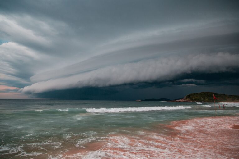
Arthur Brognoli/pexels.com
Hurricane Lowell did something on the night of September 7 that no storm had ever done to Hawaii: it triggered the state’s first tornado watch in recorded history. The National Weather Service issued Tornado Watch No. 1 for Kauaʻi County at 4:13 p.m. HST (10:13 p.m. ET) on September 7, 2026, covering the islands of Kauaʻi and Niʻihau and adjacent coastal waters as Lowell’s outer rainbands swept through the region. The watch, which expired at 4:00 a.m. HST on September 8, was widely confirmed as the first ever issued for the state by Iowa State IEM research maps. By that same morning, roughly 92% of customers served by the Kauaʻi Island Utility Cooperative — 33,000 of 36,000 member accounts — had lost power, the strongest hurricane to affect the main Hawaiian Islands since Iniki in 1992 left its mark on the Garden Isle.
Why Lowell Created a Tornado Threat Hawaii Had Never Faced
To understand why Lowell produced a tornado watch while hundreds of prior storms approaching Hawaii did not, the physics lies in a concept called the front-right quadrant. In any Northern Hemisphere hurricane, the front-right quadrant — the sector located to the right of the storm’s direction of travel, measured from the eye — is where the greatest low-level vertical wind shear occurs. Ground friction dramatically slows near-surface winds in the lowest kilometer of the atmosphere while winds at altitude maintain their momentum; the sudden difference in wind speed with height creates horizontal rotating rolls that can spin up embedded thunderstorm cells into tornadoes. On the storm’s right side, the hurricane’s own forward motion adds to the counterclockwise rotational winds, compounding the shear effect. This is why meteorologists often issue tornado watches for the right-front quadrant of landfalling hurricanes, and why Ivan’s 2004 landfall produced 29 right-front quadrant tornado reports — all within that same sector.
What made Lowell unusual, and what made this watch possible, was the storm’s track. Lowell approached Hawaii from the southwest, curving northward as it passed west of Niʻihau — placing Kauaʻi squarely in the storm’s front-right quadrant. Hurricanes approaching Hawaii from the south or southeast tend to keep the main islands in less favorable sectors. According to Yale Climate Connections meteorologists Jeff Masters and Bob Henson, it is rare for a strong tropical cyclone to approach Hawaii from the southwest in such a way that the major islands land in the forward right-hand quadrant where rotation and tornadoes become favorable. That alignment — not simply Lowell’s intensity — was the meteorological precondition for the watch. Between 1950 and 2018, Hawaii recorded 42 confirmed tornadoes according to NWS Honolulu historical records, but the atmospheric setup required to justify a proactive watch had never materialized until Lowell’s track provided it.
The NWS Honolulu office warned the public directly, saying Lowell posed a “risk of fast-moving tornadoes” near the waters off Kauaʻi and Niʻihau, and that while the risk was lower on the other islands, it was not zero.
A Storm Built Twice to Category Five
Lowell’s arrival was preceded by a meteorological journey that placed it in rare company before it ever threatened a populated coastline. The storm formed on August 27, 2026, as a tropical depression east-southeast of Hawaii. It reached hurricane strength on September 1, and by late September 2 had intensified into a Category 5 hurricane — the first in the Central Pacific basin since Hurricane Walaka in 2018 — with maximum sustained winds of 160 mph (258 km/h) and a minimum central pressure of 927 mbar (27.4 inHg), per Wikipedia’s Hurricane Lowell meteorological history.
Then the storm encountered a set of structural obstacles. Increasing wind shear and an eyewall replacement cycle — the process in which an outer ring of deep convection forms around the primary eyewall, contracts inward, and temporarily disrupts the original circulation — caused Lowell to weaken to Category 3 intensity by September 4. Eyewall replacement cycles are among the most forecast-resistant challenges in tropical meteorology; they introduce rapid swings in wind speed that standard intensity models handle poorly, as documented in NHC Discussion 33 records. As the replacement cycle completed and the new eyewall consolidated, Lowell rapidly re-intensified — reaching Category 5 status once again, with maximum sustained winds again at 160 mph (258 km/h) and a record minimum central pressure of 922 mbar (27.23 inHg), confirmed in NHC Discussion 36 records.
That double-Category 5 achievement made Lowell only the third Pacific hurricane ever to attain, lose, and regain Category 5 strength — joining Emilia in 1994 and Ioke in 2006. Hurricane Hunters confirmed the re-intensification by direct aircraft reconnaissance.
By the time Lowell passed west of Niʻihau as a Category 2 hurricane with maximum sustained winds of approximately 110 mph (177 km/h), tropical-storm-force winds extended nearly 200 miles (322 km) from the center — a radius large enough to impose hazardous conditions across the entire main Hawaiian island chain even without a direct strike on land. The Watchers confirmed that 90% of Kauaʻi customers lost power by early Tuesday morning.
Kauaʻi’s Grid Takes the Hardest Hit
The cooperative that provides electricity to essentially all of Kauaʻi — the Kauaʻi Island Utility Cooperative, which operates approximately 1,500 miles (2,414 km) of transmission and distribution lines across the island — suffered damage at a scale that KIUC CEO David Bissell described as extensive. Preliminary inspections found that distribution lines took biggest hit, with associated equipment absorbing the largest impact; transmission lines and substations were also damaged, though no significant damage was found to KIUC-owned generation units.
By Tuesday morning, roughly 33,000 of KIUC’s 36,000 member accounts — representing more than 70,000 people on the island — remained without electricity, and the cooperative said it was unable to provide any estimated restoration timeline. “Our first priority is making sure conditions are safe for our crews, emergency responders and the public,” Bissell said in a statement. The first partial restorations — 466 customers in ʻEleʻele and Hanapēpē — came Tuesday afternoon, confirmed by Kauai Now. With nearly 1,500 miles of lines to assess and no grid interconnection to draw outside power from (Kauaʻi’s is a true island system, not connected to any other island’s network), full restoration across the island was expected to take days or longer in some areas.
Statewide, more than 50,000 customers lost power at peak outage: the 33,000 on Kauaʻi and approximately 21,000 on Oahu served by Hawaiian Electric, concentrated primarily on the leeward and windward coasts, according to the Honolulu Star-Advertiser statewide outage count.
Congresswoman Jill Tokuda (D-Hawaii) told the Star-Advertiser that “Electricity is essential to health and safety, from keeping medications refrigerated and medical equipment running to preserving food, pumping water, and meeting basic needs,” framing Tokuda’s essential services warning in direct terms.
Roads Blocked, Shelters Open, Radar Dark
On the ground across Kauaʻi, the storm left roads blocked by debris, collapsed sections of the North Shore and Westside highways, and storm surge severe enough to bury some roads in sand and boulders from broken seawalls. Port Allen Small-Boat Harbor sustained severe harbor damage, vessels sunk. All flights at Lihue Airport were canceled as conditions deteriorated, with no reopening timeline given. On Oahu, Honolulu Police closed Farrington Highway in both directions after waves crossed all four lanes.
As of early Tuesday, 301 people and 38 pets had taken shelter at five Kauaʻi County emergency sites: Kauaʻi High Gym, Kalāheo Neighborhood Center, Waimea Canyon Middle School, Kīlauea Neighborhood Center, and Kapaʻa Middle School, according to Hawaii Emergency Management Agency shelter count. Governor Josh Green, who had declared a statewide emergency on September 3 and activated 129 Hawaii National Guard members before the storm made its closest approach, confirmed at least one storm-related death — a man killed by a falling tree at Sherwood Beach in Waimānalo, Oahu — and called the storm’s impact “devastating.” Green confirmed one death to media outlets.
Making monitoring conditions harder during the critical overnight hours: the National Weather Service Doppler radar on Kauaʻi was knocked offline by the storm and remained out of service through Tuesday morning, as Yale Climate Connections reported. This created a significant gap precisely during the active tornado watch — with the radar dark, NWS meteorologists lost their primary tool for detecting rotating thunderstorm cells that might produce tornadoes, and had to rely on satellite imagery and storm spotters instead. The radar is the instrument that would distinguish between a tornado watch (favorable atmospheric conditions) and a tornado warning (imminent or confirmed rotation on radar) — without it, the warning threshold became harder to clear.
Third Storm, Same Summer
Lowell was the third named storm to affect Hawaii in the 2026 Central Pacific hurricane season. Hurricane Lala made landfall on the Big Island as a Category 1 storm on August 15, leaving more than 40 inches (102 cm) of rain and earning a federal disaster declaration for Hawaii weeks before Lowell’s arrival. Hurricane Moke followed within roughly a week of Lala, also brushing the islands. The frequency is not coincidental: the 2026 El Niño, now tracking toward what NOAA’s seasonal models show at 90% probability of “super” or record intensity, warms Central Pacific sea surface temperatures above the 26°C (79°F) threshold needed to sustain tropical cyclone development while simultaneously removing the cool-water upwelling that historically acted as a natural brake on Hawaii’s storm exposure. University of Hawaiʻi–Mānoa researchers have documented El Niño cyclone frequency increases near Hawaii during El Niño years, attributing the pattern to increased atmospheric humidity and favorable wind conditions in the region.
The 2026 Central Pacific hurricane season had already produced five named storms before September, equaling a typical full-season total, with NOAA’s Central Pacific forecasts projecting as many as 13 by November. Lowell’s closest approach is considered the strongest hurricane to affect the main Hawaiian Islands since Hurricane Iniki in September 1992 — a Category 4 storm that made direct landfall on Kauaʻi’s south shore and caused $3.1 billion damage (1992 USD), killing 7 people. Iniki struck at 145 mph (233 km/h) sustained winds and remains the costliest hurricane in Hawaiian history. Lowell arrived at Category 2 and stayed offshore. The distinction matters: Iniki’s direct hit was the catastrophic version of what Lowell demonstrated on a smaller scale. Both left Kauaʻi in the dark.
How Does Hawaii Recover From Lowell?
Power restoration on Kauaʻi faces a challenge unique to island systems: there is no neighboring grid to draw power from. Every circuit restored has to be energized from within Kauaʻi’s own generation capacity, and crews must first physically inspect 1,500 miles (2,414 km) of lines before they can safely re-energize any segment. KIUC said it would prioritize critical infrastructure and high-density population areas for initial restoration efforts, while acknowledging that some areas could remain without power for an extended period. The state’s emergency management office coordinated federal ESF-12 Energy Support Function resources for the Kauaʻi Emergency Operations Center and gathered outage data to support SNAP food replacement benefits for affected residents, per HIEMA’s Lowell response release.
Governor Green closed all state and county offices, Kauaʻi Community College, and public schools across Kauaʻi and Oahu through Tuesday while cleanup and damage assessments were underway. County officials dispatched helicopters to assess damage once conditions allowed, to assess damage on road segments inaccessible by ground.
Climate scientists and Hawaiian officials are now confronting a question that three storms in one season makes increasingly urgent: with ocean temperatures climbing and El Niño reaching record strength, events like Lowell — arriving with little warning time, taxing an infrastructure already stretched by Lala — may define Hawaii’s near-term relationship with the Pacific hurricane season.
Frequently Asked Questions
Why did Hawaii get a tornado watch for the first time ever?
The watch was triggered by Lowell’s unusual southwest-to-north track, which placed Kauaʻi in the hurricane’s front-right quadrant — the sector of a Northern Hemisphere hurricane most favorable for tornado development. Ground friction slows near-surface winds sharply while winds higher in the atmosphere maintain their speed, creating a strong low-level vertical wind shear that can rotate embedded rainband thunderstorms into small tornadoes. Most Pacific storms approaching Hawaii do not produce this geometry. Lowell’s specific path did. The watch expired at 4:00 a.m. HST on September 8 without a confirmed tornado report, but the conditions were legitimately present, as explained by KOMO meteorologist George Waldenberger in a front-right quadrant explainer. Hawaii had recorded 42 tornadoes between 1950 and 2018 according to NWS Honolulu tornado records, all after the fact — this was the first time the NWS determined that conditions warranted warning residents in advance.
When will Kauaʻi’s power be restored after Hurricane Lowell?
KIUC had not provided an estimated restoration timeline as of Tuesday, September 9. The cooperative is assessing damage to approximately 1,500 miles (2,414 km) of transmission and distribution lines across the island — a process that, combined with the need to clear debris before crews can access many circuits, makes rapid restoration difficult. Kauaʻi’s island grid is not connected to any other island’s power network, so outside power cannot simply be imported. KIUC said it would prioritize critical infrastructure and high-density areas for initial restoration, with no timeline confirmed. The state is gathering outage data to support SNAP food replacement benefits for affected residents with spoiled food.
Why is Lowell considered so unusual among Pacific hurricanes?
Lowell achieved something only two Pacific hurricanes achieved previously: it reached Category 5 intensity, weakened, and then re-intensified to Category 5 a second time. The previous instances were Emilia in 1994 and Ioke in 2006. The mechanism was an eyewall replacement cycle — a structural process in which an outer convective ring temporarily disrupts and replaces the original eyewall, causing a brief weakening before the reconsolidated storm rebuilds. Lowell also became the first Category 5 hurricane in the Central Pacific basin since Hurricane Walaka in 2018. Its second Category 5 peak reached a minimum central pressure of 922 mbar (27.23 inHg), which is among the most intense pressures ever observed in a Central Pacific tropical cyclone.
Is this level of Hawaii hurricane activity normal?
No. Three named storms affecting Hawaii in a single season — Lala, Moke, and Lowell — is well above historical averages for the Central Pacific basin, which typically sees storms near the Hawaiian Islands only a handful of times per decade. The 2026 El Niño is the primary driver: it warms Central Pacific sea surface temperatures while removing the cool upwelling that historically weakened approaching storms before they could reach the islands. NOAA’s seasonal models put greater than 90% probability on this El Niño reaching “super” or historically intense status, and AccuWeather analysts have described it as potentially the strongest since at least 1950. University of Hawaiʻi–Mānoa researchers have documented a statistically significant increase in tropical cyclone frequency near Hawaii during strong El Niño years.