HomeAuto Cyclone Arnab Hits India: Engineered Early-Warning Grid Moved 136,000 to Safety
Cyclone Arnab Hits India: Engineered Early-Warning Grid Moved 136,000 to Safety
October 28, 2026:
Noah SEELAM/gettyimages.com
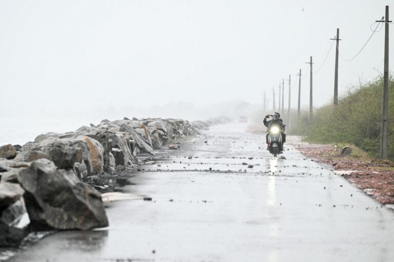
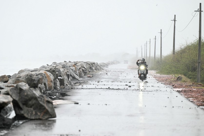
Cyclone Arnab made landfall along India’s Andhra Pradesh coast in the early hours of Wednesday, bringing sustained winds of 125–135 km/h (78–84 mph) and gusts reaching 150 km/h (93 mph) that uprooted trees and cut power across coastal districts — and the Indian government had already moved more than 136,000 people out of its path before a single gust arrived. That mass evacuation completed without casualties did not happen by accident: it is the output of a disaster preparedness infrastructure that Odisha and the India Meteorological Department built methodically over 25 years, starting from one of the worst natural disasters in modern Indian history.
Arnab is the first formally named cyclone of the 2026 North Indian Ocean season — the Bay of Bengal’s post-monsoon window, which runs from October through December and consistently produces intense storms because sea surface temperatures remain elevated after the retreating monsoon. The storm formed from a low-pressure area over the east-central Bay of Bengal on October 24, 2026, deepened into a depression on October 25, intensified into a cyclonic storm by the morning of October 26, and reached very severe cyclonic storm status — the third-highest of the India Meteorological Department’s seven-level classification scale, corresponding to sustained winds of 64–89 knots (119–165 km/h / 74–102 mph) — before bearing down on the Andhra Pradesh–Odisha coastline.
Landfall: Storm Surge, Power Cuts, and No Confirmed Deaths
The India Meteorological Department confirmed that Arnab crossed the Andhra Pradesh coast in the early hours of October 28 (Indian Standard Time), tracking between Bapatla and Visakhapatnam near the Union Territory of Yanam. The IMD warned that a storm surge of 1.5 to 2.5 metres (roughly 5–8 feet) above normal tide would likely inundate low-lying areas over the six hours following landfall. Trees were uprooted across multiple districts, and power supply was disrupted, Andhra Pradesh’s chief minister’s office confirmed — but as of the latest Reuters dispatch, no deaths had been reported.
Arnab’s outer rain bands reached well north of the landfall zone, lashing coastal Odisha districts including Kendrapara, Jagatsinghpur, Puri, Bhadrak, Khurda, and Balasore before the eye crossed land. The storm’s remnants were projected to carry heavy to very heavy rainfall into the interior — across Andhra Pradesh, southern Odisha, Telangana, and potentially Chhattisgarh — through Thursday and beyond.
Twelve trains were canceled and services on 53 rail routes along the southern coast were suspended, with railway authorities posting the disruptions on social media ahead of landfall.
How Does India’s IMD Classify Cyclones?
India uses a classification system distinct from the Atlantic hurricane scale. The IMD’s seven-level hierarchy runs: Depression → Deep Depression → Cyclonic Storm → Severe Cyclonic Storm → Very Severe Cyclonic Storm → Extremely Severe Cyclonic Storm → Super Cyclonic Storm. Arnab’s “very severe” rating — introduced as a formal category in 1999, the same year as the devastating Odisha Super Cyclone — indicates sustained winds of 119–165 km/h (74–102 mph). Storms receive their formal name only after reaching the cyclonic storm threshold of at least 34 knots (approximately 62 km/h / 39 mph).
The name “Arnab” was contributed by Bangladesh to the World Meteorological Organization’s North Indian Ocean naming roster — a rotating list maintained by 13 member nations including India, Bangladesh, Iran, Myanmar, and others. In Bengali, arnab means “ocean” or “sea.” The name had been reserved as the next available designation on the roster; a deep depression that crossed the Andhra Pradesh–Odisha coast in late September 2026 without reaching cyclonic storm intensity never received the name.
Why the Bay of Bengal Keeps Producing These Storms
The Bay of Bengal is the most active sub-basin of the North Indian Ocean and one of the deadliest cyclone breeding grounds on earth — its coast is shared among India, Bangladesh, Myanmar, Sri Lanka, and Thailand, and dense coastal populations amplify every storm’s human cost. During the post-monsoon season, the Bay’s sea surface temperatures remain warm — typically 28–33°C (82–91°F) — even as the monsoon retreats. These elevated temperatures, combined with a strong near-surface halocline created by the monsoon’s heavy river discharge and rainfall, suppress the cyclone-induced ocean cooling that would normally weaken storms. The result: post-monsoon Bay of Bengal cyclones can intensify rapidly and sustain their intensity longer than in other basins.
Arnab’s progression from a low-pressure area to a very severe cyclonic storm in roughly three days — October 24 to 26–27 — reflects exactly this dynamic. The most recent benchmark comparison is Cyclone Amphan in 2020, which intensified explosively over Bay of Bengal sea surface temperatures of 33°C (91°F).
Odisha’s Evacuation Infrastructure: Built From a Catastrophe
The numbers behind India’s Arnab response — 136,000+ people evacuated before landfall, 466 cyclone and flood shelters activated in Odisha, 380 fire service teams on standby, 31 National Disaster Response Force teams across five states and the Union Territory of Yanam — did not emerge from improvisation. They are the outputs of an infrastructure built in direct response to the 1999 Odisha Super Cyclone, which killed nearly 10,000 people and remains one of India’s deadliest natural disasters.
The transformation is documented. In April 2018, Odisha became the first Indian state to install a dedicated Early Warning Dissemination System (EWDS) for cyclones and tsunamis along its 480 km (298 mi) coastline — a network of watchtowers at 122 shore locations, each equipped with sirens and mass-messaging capability capable of reaching fishing communities and low-lying villages that traditional communication channels miss. Paired with the National Cyclone Risk Mitigation Project — which built more than 900 multi-purpose cyclone shelters along the Odisha coast — these systems created the “last-mile connectivity” that disaster management researchers credit for the state’s shift from mass-casualty events to near-zero-casualty outcomes.
Professor Santosh Kumar of the National Institute of Disaster Management, who studied Odisha’s response to both the 1999 Super Cyclone and Cyclone Fani in 2019, has characterized the state’s approach as a global model. “If there is a model of preventing large-scale deaths in disaster, we can call it the Odisha model,” Kumar said. The UN recognized Odisha’s preparedness after Cyclone Phailin in 2013 — which struck with similar intensity to the 1999 disaster but killed far fewer people — as a global success story.
In June 2026, Odisha’s Revenue and Disaster Management Minister Suresh Kumar Pujari presented the state’s disaster framework at the BRICS Disaster Risk Reduction Working Group meeting in Puri — hosted in Odisha specifically because the state had been selected as an internationally recognized model of cyclone governance. Pujari is the same minister who, on October 27, announced the evacuation of 47,830 people across eight southern Odisha districts and the release of Rs 19 crore (approximately $2 million USD) in emergency funding for affected districts.
Scope of Arnab Evacuations: District-by-District
More than 12 million people along Arnab’s path in Andhra Pradesh alone, according to the state’s disaster management authority. Andhra Pradesh identified approximately 570,000 people as directly vulnerable and began evacuating coastal residents Monday evening, opening more than 2,000 cyclone shelters across 20 districts and dispatching emergency alerts to millions of mobile phones across districts.
In Odisha, the district-level breakdown of 47,830 evacuees illustrated the depth of planning behind the figures. Nabarangpur saw the most relocations at 11,090 residents; Gajapati followed with 11,000; Malkangiri with 9,850; Ganjam with 6,500; Koraput with 5,000; Kalahandi with 2,415; Nuapada with 1,675; and Rayagada with 300. Gajapati district — hilly, landslide-prone terrain in southern Odisha — drew particular attention from officials; Collector Akshay Sunil Agarwal noted that approximately 1,500 of the most vulnerable residents, including pregnant women and elderly people, had been moved to cyclone shelters and temporary relief camps before landfall.
Emergency funding allocations from the State Disaster Relief Fund broke down as follows: Ganjam received Rs 5 crore (approximately $525,000 USD); Malkangiri, Koraput, Rayagada, Gajapati, Nabarangpur, Kalahandi, and Kandhamal each received Rs 2 crore (approximately $210,000 USD each).
Fishers Stranded, Ports on Emergency Footing
Thirty-five fishing boats carrying 305 fishers from Andhra Pradesh had taken shelter at Paradip Port in Odisha’s Jagatsinghpur district by the evening of October 26, stranded after strong winds, heavy rain, and rough Bay of Bengal seas blocked their return to Visakhapatnam Fishing Harbour. Paradip Port Authority Chairperson Susanta Kumar Purohit coordinated with Indian Coast Guard and Odisha Marine Police to berth the vessels safely. The IMD extended its fishers’ advisory — warning all vessels to stay ashore — through at least October 29.
Misinformation Warning From Officials
As the storm intensified, Odisha’s Office of the Special Relief Commissioner took the unusual step of formally warning on October 26 that individuals deliberately spreading false disaster alerts could face legal action. The government identified unverified claims about Arnab’s track, landfall timing, and expected impact circulating through social media and some media outlets without scientific validation. Print, electronic, and digital media organizations were asked to verify all weather information against official IMD bulletins and district disaster management authority advisories before publishing. District collectors were directed to actively counter misinformation and ensure authenticated warnings reached the public.
What Comes Next
Arnab was expected to weaken gradually as it moved inland Thursday, but its remnants were forecast to carry significant rainfall — heavy to very heavy — through Andhra Pradesh, southern Odisha, Telangana, and potentially Chhattisgarh through the end of the week. Meteorologists were also monitoring a separate system potentially threatening Odisha’s coast, though any such threat remained highly speculative at the time of writing.
Schools in five vulnerable Odisha districts — Ganjam, Gajapati, Rayagada, Koraput, and Malkangiri — will remain closed through October 28 and 29. Schools, colleges, and Anganwadi childcare centers across at least ten Andhra Pradesh districts were closed in the storm’s immediate aftermath, with Anakapalli under a three-day closure order running through October 29. Teachers and administrative staff in Andhra Pradesh were directed to remain at their posts during the closures.
Nepal’s disaster authorities advised trekkers and tourists to stay away from high-altitude areas through the weekend, citing the risk of heavy rain, snowstorms, and avalanches triggered by Arnab’s remnants reaching the Himalayas.
Exchange rate as of October 26, 2026; conversions are approximate.
Frequently Asked Questions
Has Cyclone Arnab caused deaths?
As of the most recent confirmed report — a Reuters dispatch filed in the early hours of October 28 (Indian Standard Time) as landfall was beginning — no deaths had been reported. Andhra Pradesh’s chief minister’s office confirmed trees were uprooted and power disrupted, but zero casualties. This reflects the effectiveness of pre-landfall evacuation but does not preclude later reports as the storm moves inland through Thursday.
What is the “Odisha model” that disaster officials keep citing?
It refers to a disaster preparedness infrastructure built in Odisha after the 1999 Super Cyclone killed approximately 10,000 people — one of India’s worst natural disasters. Over 25 years, Odisha constructed more than 900 multi-purpose cyclone shelters along its coast, installed an Early Warning Dissemination System (EWDS) with 122 coastal watchtowers equipped with sirens and mass-messaging capability, and embedded community-level disaster preparedness programs at the village level. The result has been a dramatic reduction in cyclone deaths even for storms of comparable intensity: Cyclone Phailin (2013) and Cyclone Fani (2019) both struck with extreme force and caused far fewer deaths than the 1999 disaster. The BRICS nations formally acknowledged the model in June 2026 when they held their Disaster Risk Reduction Working Group meeting in Puri, Odisha specifically to study the state’s approach.
What is a “very severe cyclonic storm” and how does India classify cyclones?
India’s meteorological agency, the IMD, uses a seven-level scale rather than the Saffir-Simpson hurricane scale familiar to US audiences. From weakest to strongest: Depression, Deep Depression, Cyclonic Storm, Severe Cyclonic Storm, Very Severe Cyclonic Storm, Extremely Severe Cyclonic Storm, and Super Cyclonic Storm. “Very Severe” — Arnab’s classification — is the third-highest tier, defined by sustained three-minute winds of 64–89 knots (119–165 km/h / 74–102 mph). A storm receives its formal name from the WMO/IMD naming roster only after sustaining winds of at least 34 knots (~62 km/h / 39 mph) for an extended period; a deep depression that crossed the same Andhra Pradesh–Odisha coast in late September 2026 without reaching that threshold was never formally named Arnab.
Why does the Bay of Bengal produce so many intense post-monsoon cyclones?
The Bay of Bengal is one of the world’s most active cyclone basins, and its post-monsoon season (October–December) is particularly dangerous for a specific oceanographic reason. After the monsoon retreats, sea surface temperatures remain elevated — typically 28–33°C (82–91°F) — while the monsoon’s heavy rainfall and river discharge creates a layer of low-salinity water at the Bay’s surface. This halocline acts as an insulating lid that suppresses the upwelling of cooler, deeper water that would normally reduce a cyclone’s energy. Without that natural brake, storms can intensify rapidly and maintain their strength longer than in other ocean basins. Arnab’s progression from a low-pressure area to a very severe cyclonic storm in roughly three days is consistent with these Bay of Bengal dynamics.