HomeAuto Canada Opens Formal Talks on Galileo Access as Arctic GPS Accuracy Degrades to 1 Kilometer
Canada Opens Formal Talks on Galileo Access as Arctic GPS Accuracy Degrades to 1 Kilometer
October 31, 2026:
Esa.int
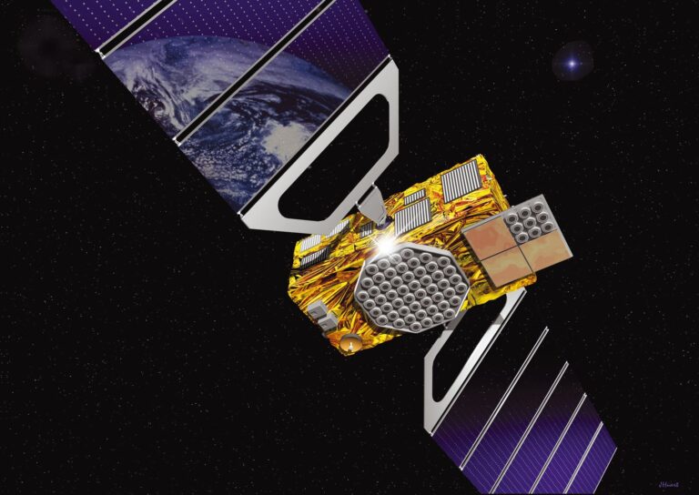
Canada signed two landmark space agreements at the 21st Canada-EU Summit in Montreal on Friday, opening formal negotiations to access Galileo’s government-grade encrypted navigation signal for the first time — a signal engineered to resist the jamming and spoofing that makes ordinary GPS a liability in a contested environment. The Canadian Armed Forces have documented Arctic GPS positional error reaching 1 kilometer (0.62 miles) in the high Arctic, where low satellite elevation angles degrade the system that underpins $1 billion in daily economic activity.
The agreements, signed by Foreign Affairs Minister Mélanie Joly and EU Commissioner for Defence and Space Andrius Kubilius under the broader Canada-EU Alliance for the Future, formalize two parallel tracks: negotiations toward a framework for Canadian access to Galileo services — including the Public Regulated Service, Galileo’s encrypted, anti-spoofing government signal — and exploratory talks on an administrative arrangement covering Canada’s potential involvement in IRIS², the EU’s €15.6 billion next-generation secure satellite constellation (approximately $17.47 billion USD).
That Canada needs an alternative is not theoretical. When GPS satellites appear near the horizon — as they do routinely across Canada’s high Arctic — their signals travel through more atmosphere, accumulating error that can push positional accuracy from the sub-meter precision available in southern cities to a range measured in city blocks. The encrypted Galileo signal, traveling a similar path, would add a second constellation with different orbital geometry, cutting through that degradation by giving receivers more satellites at usable angles.
What Galileo’s Public Regulated Service Does That GPS Cannot
Galileo’s Public Regulated Service is not simply GPS with a European flag. The PRS is an encrypted, wideband signal broadcast on Galileo PRS frequency bands of 1,575.42 MHz and 1,278.75 MHz. That wideband design provides more processing gain against jamming than GPS’s civilian signals — interference that drowns out a narrow signal is spread thin across a wider band, becoming noise the receiver can filter out.
Anti-spoofing goes deeper still. Galileo employs a Signal Authentication System that hides its spreading codes during transmission, releasing the encrypted keys only after a signal has already been broadcast. An attacker trying to inject a fake Galileo PRS signal cannot know the correct codes in advance. Even if they capture a code, it has already been used. This is a structural advantage over GPS open signals, whose pseudorandom noise codes are published and can be replicated by anyone with the right hardware.
For open-service users, Galileo also provides OSNMA — Open Service Navigation Message Authentication — a cryptographic mechanism that lets receivers verify navigation messages were genuinely transmitted by Galileo satellites rather than generated by a ground-based spoofer. Taken together, PRS and OSNMA represent a navigation security architecture that has no direct equivalent in the US GPS system.
Canadian access to PRS would require establishing a Competent PRS Authority — likely under the Communications Security Establishment — plus procurement of PRS-capable receivers for defense and critical infrastructure applications. The October 30 agreements open negotiations toward that architecture; they do not grant access. Norway, the first non-EU nation to pursue Galileo cooperation with PRS access, established that the path is navigable but requires patient diplomacy.
Canada’s relationship with Galileo is not new. In 2003, Ottawa invested $11 million CAD in Galileo’s Development and Validation Phase, a technical partnership that predates the system’s initial service capability by 13 years. The October 30 agreements represent a formalization of that long relationship into a framework with operational teeth.
What Galileo Already Offers Canada — Without Any Agreement
While PRS access requires a formal treaty, the Galileo High Accuracy Service has been freely available globally since January 24, 2023. HAS broadcasts sub-20-centimeter (approximately 8-inch) position corrections at no cost, and the October 30 summit documents indicate Canada’s geodetic partnership includes formalizing HAS integration into Natural Resources Canada’s national survey infrastructure.
This is meaningful independently of the PRS negotiations: Canada’s land surveying, precision agriculture, construction layout, and resource extraction sectors can begin building on centimeter-level Galileo corrections immediately, without waiting for the PRS agreement to conclude.
GPS and the Infrastructure Risk Beyond Navigation
The case for multi-constellation access in Canada goes well beyond where a smartphone places a blue dot. PNT — Positioning, Navigation, and Timing — is the full infrastructure category GPS provides, and the “timing” dimension carries stakes that most coverage misses.
Global navigation satellite systems provide nanosecond-level time synchronization that underlies cellular 5G and LTE timing synchronization, financial transaction timestamping, power grid phase synchronization, and internet routing protocols. A GPS outage is not merely a navigation inconvenience; it is a potential cascade across financial systems, telecommunications, and the power grid.
Canada’s Innovation, Science and Economic Development ministry acknowledged this explicitly in its PNT Resilience Framework, announced October 22, 2026 — eight days before the Montreal summit. The framework identifies 10 action areas, including establishing a national PNT office, building domestic sovereign timing infrastructure, and deploying interference monitoring networks across Canadian territory.
MDA Space Already Has Skin in the EU Constellation
The IRIS² dimension of Friday’s agreements carries an important asymmetry: while Canada’s government is at the beginning of exploratory talks, Canadian industry has been inside the program for months.
MDA Space — Canada’s publicly traded satellite component manufacturer, known for the Canadarm and for radar and antenna systems — confirmed a $100 million IRIS² antenna contract with Thales Alenia Space to build digital antennas for the first 66 IRIS² satellites. The commercial deal preceded Friday’s government arrangements and was negotiated independently through the SpaceRISE consortium’s IRIS² concession (formed by Luxembourg’s SES, France’s Eutelsat, and Spain’s Hispasat, which holds the IRIS² concession).
MDA CEO Mike Greenley framed the contract as proof of Canadian competitiveness. “MDA has long believed Canada needs to develop more domestic space capabilities,” he said, a position that acquired fresh weight when the GPS-vulnerability numbers he publicly attributed to Canadian Armed Forces analysis — citing documented Arctic GPS accuracy degradation of 100 meters (328 feet) to 1 kilometer (0.62 miles), and $1 billion in daily economic exposure — became part of the public case for Friday’s agreements.
IRIS²: What Canada Is and Is Not Seeking
Precision matters about what the IRIS² arrangement actually is. Canada is not joining IRIS². The October 30 administrative arrangement establishes a framework for dialogue and information sharing — exploratory talks in the plain meaning of those words. Full IRIS² participation, which would involve financial contribution and service access, remains a potential future outcome of those talks.
IRIS² is a 348-satellite constellation with mixed orbit — 330 in low Earth orbit at roughly 1,200 kilometers (746 miles) altitude and 18 in medium Earth orbit at roughly 8,000 kilometers (4,971 miles) altitude. The hybrid architecture combines LEO’s low latency and strong ground signal with MEO’s broader coverage footprint. First launches are planned for 2029, with initial government services targeted for 2030.
The program’s budget has grown since the December 2024 contract signing. The original SpaceRISE concession was valued at €10.5 billion USD (approximately $11.76 billion USD). A IRIS² August 2026 budget renegotiation revised the total program budget to €15.6 billion (approximately $17.47 billion USD).
The EU has already established a precedent for non-EU associated participation in its government satellite communications programs. Norway and Iceland joined GOVSATCOM and IRIS² programs in March 2026, and the EU’s interim governmental satcom pooling program became operational in January 2026. Canada’s exploratory talks on IRIS² place it on a similar trajectory, with GOVSATCOM participation a likely intermediate step.
Canada’s Parallel Domestic Bet
Even as it pursues European constellation access, Canada is hedging with domestic investment. On October 20, 2026, Joly announced a federal Xona Space investment of $15 million CAD in Xona Space Systems, a company with a Montreal engineering hub that is developing the Pulsar LEO PNT constellation — a private, purpose-built positioning network promising centimeter-level accuracy from low Earth orbit.
The Xona investment and the Galileo negotiations are not competing strategies. Galileo PRS provides near-term access to proven, deployed encrypted navigation infrastructure; Xona’s Pulsar constellation, still in development, offers a path toward sovereign, North American-controlled PNT capability with positioning performance GPS cannot match. Canada’s PNT Resilience Framework explicitly anticipates both tracks.
The Diplomatic Context
Friday’s space agreements were signed under the umbrella of the Canada-EU Alliance for the Future, a broader framework covering trade, digital economy, energy, security, and people-to-people ties — the most substantive Canada-EU bilateral framework in years.
Foreign Affairs Minister Joly and EU space commissioner Kubilius co-signed the space-specific arrangements. Kubilius, the EU’s first Commissioner for Defence and Space, has positioned IRIS² as a cornerstone of European strategic autonomy in space — explicitly framing it as an alternative to commercial US constellations such as Starlink for government applications. His presence at the signing signals that the EU views Canada’s participation pathway as strategically aligned with European interests, not merely a commercial arrangement.
For Canada, access to Galileo is also a statement about which navigation architectures it trusts. Russian GLONASS and Chinese BeiDou provide comparable positioning capabilities on paper, but neither is a credible alternative for a NATO ally’s defense infrastructure. The Galileo pathway gives Canada a trusted-ally constellation with anti-spoofing architecture purpose-built for a contested signal environment.
Currency conversions in this article from EUR to USD are approximate and based on exchange rates as of October 30, 2026.
Frequently Asked Questions
What is the difference between Galileo and GPS, and why does it matter for Canada?
GPS and Galileo are both satellite navigation systems that use timed radio signals from orbiting satellites to calculate position, but they differ structurally in ways that matter for security and Arctic coverage. GPS was designed as a US military system with civilian access granted by presidential order — meaning that access is a privilege, not a right, and could theoretically be restricted. Galileo was built by the EU from the outset as a civilian-controlled system, with Canada and other allied nations able to negotiate formal access agreements. On accuracy: Galileo’s commercial service achieves sub-20-centimeter positioning using its free High Accuracy Service. On security: Galileo’s encrypted Public Regulated Service uses a code-hiding architecture that makes it far harder to spoof than GPS’s published pseudorandom codes. At high latitudes, Galileo’s satellite orbital geometry provides better positional coverage in Canada’s Arctic, where GPS accuracy can degrade to between 100 meters (328 feet) and 1 kilometer in the high Arctic (0.62 miles).
What is the Public Regulated Service, and does Canada have access to it now?
The PRS is Galileo’s encrypted, government-only navigation signal, designed for defense, emergency services, and critical infrastructure. It is broadcast on wideband frequencies that resist jamming, and its spreading codes are cryptographically hidden during transmission — making it exceptionally difficult to spoof. Canada does not have PRS access as of October 30, 2026. The agreements signed at the Canada-EU Summit open formal negotiations toward a framework that could eventually grant access. Gaining PRS access would require Canada to establish a designated Galileo PRS Competent Authority (likely under the Communications Security Establishment), acquire PRS-compatible receivers, and conclude a bilateral intergovernmental agreement with the EU. Norway has been pursuing a similar path as precedent for Galileo cooperation — the first non-EU nation to formalize such discussions.
Why does GNSS timing matter beyond navigation — and what is Canada’s exposure?
GNSS satellites do more than pinpoint locations: they provide nanosecond-precision time signals that synchronize 5G and LTE cellular networks, power-grid phase management, financial transaction timestamps, and internet routing protocols. A GPS outage or sustained jamming campaign does not merely scramble navigation — it threatens the timing backbone of financial systems, telecommunications, and power infrastructure. Canada’s PNT Resilience Framework October 2026 explicitly identifies this timing dependency as a national vulnerability and calls for sovereign timing infrastructure, a national PNT office, and interference monitoring networks as part of a 10-point action plan.
When will Canada actually have access to Galileo services, and what comes next?
The October 30 agreements are the beginning of a process, not the end. Formal negotiations toward a Galileo access framework will take time — Norway’s similar process has unfolded over several years. The HAS (High Accuracy Service) is already freely available globally, including to Canada, and the summit documents confirm integration into Canada’s geodetic survey infrastructure is part of the current arrangement. PRS access, which requires a formal intergovernmental agreement and the establishment of a Competent PRS Authority in Canada, is a later step. On IRIS²: the administrative arrangement for exploratory talks runs ahead of any decision on Canadian participation. The initial government services beginning in 2030, with first launches planned for 2029, gives the talks meaningful time to develop before the constellation becomes operational.