HomeAuto Amazon Floodplains Lost Area Size of Belgium: Land Designation Decides What Survives
Amazon Floodplains Lost Area Size of Belgium: Land Designation Decides What Survives
October 20, 2026:
Pascal Schmidt/gettyimages.com
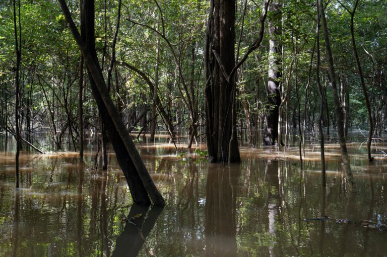
Every year, Amazonian rivers spill over their banks and drown the forests around them for months at a stretch. Brazil’s land governance system — not climate, geography, or poverty alone — determines whether those forests will still be standing when the waters recede, a peer-reviewed study published today in Nature Scientific Reports has found. The study, led by ecologist Guilherme Lobo of the State University of Campinas (UNICAMP), put satellite numbers to what land-rights researchers have long suspected: Brazil has cleared a Belgium-sized swath of its most ecologically critical wetlands, and the pace of loss is getting worse.
Forty Years of Loss, Accelerating in the Last Decade
Amazon floodplain forests — called várzea where nutrient-rich whitewater rivers dominate and igapó along the darker, sediment-poor blackwater streams — cover roughly 30% of the Brazilian Amazon. They are the most species-rich floodplain forests on Earth, store significant carbon stocks, and furnish the ecological foundation for the Amazon’s fisheries and the livelihoods of millions of riverine families who farm and fish in rhythm with the annual floods.
The new study analyzed satellite and land-cover data across the entire Brazilian Amazon floodplain from 1984 to 2024, tracking changes across 13 distinct categories of land designation. The headline figure: more than 6% of floodplain forests and other wetland areas has been cleared over the last 40 years.
“When we think about 6%, we may get the impression that it’s small, but the converted area is basically the size of Belgium,” Lobo told Mongabay by phone. Belgium covers approximately 30,528 square kilometers (about 11,787 square miles, roughly the area of Maryland).
The trajectory is what makes the numbers alarming. Nearly one-third of that 40-year total was lost in just the most recent decade — between 2015 and 2024. That acceleration did not occur randomly. It tracked specific changes in land governance and political signals about enforcement.
Where Government Inaction Functions as a Deforestation Policy
The study’s most consequential finding is what happens on land the Brazilian government has simply chosen not to designate. Undesignated public land — territory the federal or state governments own but have never assigned to any conservation category, Indigenous reserve, agrarian settlement, or other defined use — showed the highest conversion rate of any category analyzed: a median of nearly 14% of its wetlands cleared.
That outcome is not an accident. It is the predictable result of a well-documented legal mechanism called grilagem — Brazilian land grabbing — in which individuals clear public forest to signal occupancy, then use the cleared land as evidence of “productive use” to claim a title from government agencies. The mechanism converts government inaction on land designation into a race to clear: the first person to deforest the tract wins the right to it.
A 2026 study by Imazon — a Brazilian research institute that has tracked Amazon land governance for more than 15 years — documented that federal and state land laws across all nine Amazonian states actively create incentives for this practice. The institute has found that 40 to 60 percent of undesignated public land in the Amazon falls under state — not federal — jurisdiction, meaning that federal government commitments to reduce deforestation do not reach this category of land.
Separate research by Imazon found that only 7% of judicial decisions against land grabbers result in convictions, creating systemic impunity that reinforces the rational calculus to clear. Brazil also lacks a unified land registry system — a single database linking environmental data to title records — which allows the same land to be claimed and registered in multiple places simultaneously.
“The problem is in the design,” Lobo said. “What separates the categories that conserve from those that don’t isn’t only having an owner — it’s having rules.”
What Protects Floodplains: Indigenous Recognition, Formal Designation
At the opposite extreme, the data show that formal recognition of existing stewardship works with remarkable precision. In formally recognized Indigenous territories, just 0.2% of wetlands had been converted. In Indigenous lands still awaiting official demarcation, the figure was 0.3%. Military-controlled areas recorded the single lowest rate of all 13 categories — under 0.01%. Strictly protected conservation areas held losses below 0.3%.
The gap between best and worst performers is not marginal. Undesignated public land lost wetlands at roughly 70 times the rate of formally recognized Indigenous territory. Lobo read that finding in blunt terms. “In other words, those people already lived there and already protected it. It was a matter of formalization,” he said.
A parallel body of research confirms the pattern at larger scale. Since 2008, 28% of all Amazon deforestation has occurred specifically in agrarian reform settlements — government-designated land — according to data from the Climate Policy Initiative. A 2022 MapBiomas analysis found that between 1990 and 2020, Indigenous territories lost only 1% of their native vegetation while private land in the same region lost more than 20%.
Agrarian Settlements: When Land Policy Undermines Itself
The study’s most complex finding concerns government agrarian reform settlements — plots distributed to landless farming families under Brazil’s decades-old land reform program, administered by INCRA (the National Institute for Colonization and Agrarian Reform). These settlements recorded the fastest annual wetland-clearing rate of any category.
Within five years of being created, settlements cleared 1.4% of their wetlands per year — up from 0.9% before settlement. After 15 years, 24% of wetlands within those settlements had been converted for human uses, up from 8.5% before settlement.
The mechanism here is structural, not individual. INCRA settlement programs require occupants — typically smallholder farming families — to put land to productive use as a condition of securing their title. The programs simultaneously offer little environmental monitoring and almost no support for alternative livelihoods, such as the sustainable fisheries and flood-cycle agriculture that floodplain ecology naturally enables. Families facing legal pressure to demonstrate “productive use” rationally convert the wetlands that a different policy framework would incentivize them to protect.
The contrast with a parallel settlement model is instructive. Land designated for sustainable agrarian reform settlements — where families hold land collectively and are explicitly supported in harvesting forest products — also saw wetland conversion, but more gradually: from 2.4% to about 3.5% over the same time period. The difference in design produces a measurable difference in outcome.
How Much Does Amazon Floodplain Biodiversity Depend on These Forests?
The urgency of this governance failure becomes clearer when measured against what is at stake. A separate 2024 study in Nature Ecology & Evolution — one Lobo co-authored with a team of researchers led by John Ethan Householder — found that one-sixth of Amazonian tree diversity is ecologically specialized on river floodplains, with the most compositionally distinct communities concentrated in areas of highest flood magnitude.
That means floodplain forests are not merely one habitat among many that can be cleared and compensated by preservation elsewhere. The species specialized on floodplains — dependent on the flood pulse, the nutrient cycles of whitewater rivers, or the specific architecture of seasonally inundated forest — cannot relocate to upland terra firme forests. The study’s authors called for whole-basin hydrological integrity as a prerequisite for protecting Amazon tree diversity. The governance failures documented by Lobo et al. directly undermine that integrity: a floodplain wetland cleared for cattle pasture cannot restore the ecological functions that made it irreplaceable.
Floodplain forests also furnish crucial ecosystem services at a scale that extends far beyond the forests themselves, including flood mitigation, water purification, and fisheries support. The Amazon’s extraordinary fish diversity — which sustains commercial and subsistence fisheries across a river basin covering more than 7 million square kilometers (about 2.7 million square miles) — depends directly on the floodplain food-web architecture that cleared wetlands can no longer support.
What the Data Says About the Road Forward
The Lobo study’s data contains an implicit policy prescription: the categories of land that conserve best are those with the clearest governance structures and the most formally recognized existing stewardship. That suggests a specific set of interventions.
Accelerating the recognition of pending Indigenous territories is among the most cost-effective options the data supports. The difference between the 0.2% conversion rate in formally recognized territories and the 0.3% rate in territories awaiting demarcation is small — but pending territories remain legally vulnerable to the grilagem mechanism in ways that demarcated ones do not. Brazil’s current administration has resumed the demarcation process that was frozen under former president Jair Bolsonaro, but the backlog of territories still awaiting full recognition remains substantial.
Ending the structural incentive for grilagem requires reforming what Imazon researchers have called Brazil’s “perverse legal incentives”: the repeated amnesties for prior land grabbing (major changes in 2004 and again in 2017 effectively legalized past grilagem), the below-market pricing for public land sales that makes speculation profitable, and the absence of a unified land registry that would make duplicate or fraudulent title claims detectable before they are registered.
Redesigning agrarian settlement programs — specifically, replacing the “productive use” mandate with frameworks that support sustainable livelihoods from intact floodplains — could reverse the worst settlement performance without displacing the families who depend on the program. The more gradual clearing rates in sustainable-use settlement models suggest that the problem is not the presence of people on floodplain land but the rules under which they hold it.
Brazil’s deforestation rates have improved in recent years: overall Amazon deforestation fell 23.5% in 2025 compared with 2024, according to MapBiomas, with Indigenous land deforestation hitting an eight-year low. But the Lobo study covers a 40-year structural pattern that runs beneath any single administration’s enforcement record. Fewer trees being cut in the upland Amazon does not by itself address the specific governance vacuum that makes Amazon floodplains — undermonitored, underrepresented in policy, and ecologically irreplaceable — the most legally exposed habitat in one of the planet’s most important ecosystems.
Frequently Asked Questions
Why does undesignated public land lose so much more Amazon wetland than protected areas?
Undesignated public land is the primary target of grilagem — the practice of clearing forest to signal occupancy and then claiming a title from government agencies. Brazilian law has repeatedly treated deforestation as evidence of “productive use,” which makes a cleared wetland legally valuable as a title claim in a way that an intact one is not. Because undesignated land has no legal owner whose interests the state is obligated to protect, and because enforcement is weak (only about 7% of land-grabbing court cases end in conviction), the rational economic incentive is to clear as quickly as possible. The 14% wetland conversion rate on undesignated public land — versus 0.2% inside formally recognized Indigenous territories — reflects the structural difference between having rules and not having them.
Does recognizing Indigenous land rights actually protect Amazon wetlands?
The data suggest it does so very effectively. Formally recognized Indigenous territories showed a 0.2% wetland conversion rate, while territories awaiting recognition recorded 0.3% — both far below the 14% rate on undesignated public land. Lobo described the finding directly: “those people already lived there and already protected it. It was a matter of formalization.” Separate MapBiomas research found that Indigenous territories lost approximately 1% of native vegetation between 1990 and 2020, compared with more than 20% on private land in the same region. The conservation result does not come from the act of removing Indigenous communities — it comes from formally recognizing the stewardship they were already practicing.
What is grilagem, and why can’t Brazil simply enforce the laws against it?
Grilagem is the illegal appropriation of public land through document falsification or the use of deforestation as proof of occupancy. The word comes from the historical practice of aging forged documents by placing them in drawers with crickets (grilos in Portuguese), whose droppings yellowed the paper. Today it operates through corruption in title-registration systems, false data in land-management databases, and lobbying to modify land laws retroactively. Enforcement faces three structural obstacles: only 7% of legal actions against grilagem result in convictions; Brazil lacks a unified land registry linking environmental data to title records, making fraud detectable only after the fact; and successive laws — most recently in 2004 and 2017 — have effectively amnestied prior grilagem, creating the expectation that future violations will also eventually be legalized.
Why does Brazil’s agrarian reform program cause so much floodplain clearing?
Settlement programs administered by INCRA require families to demonstrate “productive use” of the land they receive — typically through agriculture or cattle ranching — as a condition of securing their title. On floodplain land, where seasonal flooding makes conventional farming difficult and where intact forest would sustain higher-value fisheries and forest products over the long run, this mandate creates direct pressure to clear wetlands that a different policy framework would leave standing. The study found that 24% of wetlands inside standard settlements had been converted within 15 years of settlement creation, compared with 3.5% in sustainable-use settlement models where collective land holding and forest-product harvesting are the design baseline. The clearing is not a failure of the families — it is a predictable response to the rules under which they hold their land.