HomeAuto El Niño’s Gulf Blind Spot: Category 3 Isaias Strikes During Quietest Season in 60 Years
El Niño’s Gulf Blind Spot: Category 3 Isaias Strikes During Quietest Season in 60 Years
October 11, 2026:
Joe Raedle/gettyimages.com
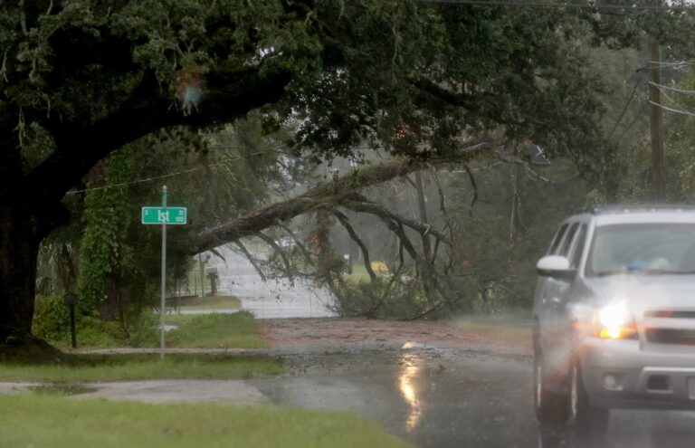
Hurricane Isaias made landfall Friday night near Destin, Florida, as a major hurricane — the first Atlantic hurricane of a 2026 season so suppressed by El Niño that it had not produced a single storm of that strength in more than four months. Simultaneously, Hurricane Simon was rapidly intensifying in the eastern Pacific toward what forecasters expected would be a dangerous Category 4 strike on Mexico’s Jalisco coast by Sunday, while Tropical Storm Rachel’s remnants are expected to bring dangerous surf to Southern California and Baja California over the weekend. Three tropical cyclones from two ocean basins, bearing down on North American coastlines in the same weekend — and the same climate phenomenon, El Niño, made all of it possible.
The lesson embedded in this convergence is one that meteorologists have been warning about for months: a “quiet” El Niño Atlantic season is not a safe one. “The season has been completely dead — and we’re still going to have an impactful storm hitting the northern Gulf,” Colorado State University hurricane expert Phil Klotzbach said as Isaias formed.
The atmospheric science governing what happened this weekend is well understood, but its implications cut against the popular shorthand that El Niño years are safe years for the Atlantic. They are not — they are shifted years, in which the Gulf of Mexico retains its hurricane risk even as the tropical Atlantic and Caribbean become relatively hostile to storm development.
Isaias Made History Before It Made Landfall
Isaias formed on Wednesday, October 7, as the ninth named storm of the 2026 Atlantic season — and the season’s first hurricane, a title it did not claim until late Wednesday night, when it crossed the 74 mph sustained-wind threshold that formally upgrades a tropical storm. That timing set a record: the latest first hurricane in the Atlantic satellite era, which dates to the mid-1960s, surpassing any prior October record set on September 11 in both 2002 and 2013 by nearly a full month. The storm came within one day of tying a record set in 1905 — 121 years earlier.
By the afternoon of October 9, Isaias had peaked as a Category 3 major hurricane with sustained winds of 115 mph (185 kph). The Alabama Emergency Management Agency reported that afternoon that hurricane-force winds extended 35 miles (56 km) from the center, with tropical-storm-force winds reaching 205 miles (330 km) out. Landfall came Friday evening near Destin and Fort Walton Beach, in the western Florida Panhandle. The storm weakened slightly in the final hours before landfall — a common occurrence as storms encounter stronger upper-level winds near the coast — but delivered Category 2 sustained winds at the moment of crossing.
The Gulf Coast communities in Isaias’s direct path have seen major hurricanes before. Hurricane Michael leveled swaths of the Florida Panhandle near Panama City in 2018 as a Category 5. Isaias struck a different corridor — further west, near the Destin–Fort Walton Beach area — and while it was less powerful than Michael, it arrived with a storm surge threat the region takes seriously. The National Hurricane Center warned of surge reaching up to 9 feet (2.7 m) above ground in the most exposed portions of the coast between Mobile Bay, Alabama, and the Florida Panhandle, a zone where the shallow bathymetry of the northeastern Gulf acts as an amplifier, allowing wind-driven water to pile far higher than it would against a steeply-shelved coast.
Alabama Governor Kay Ivey and Florida Governor Ron DeSantis issued overlapping emergency declarations covering 40 Alabama counties and 25 Florida Panhandle and Big Bend counties respectively. Mandatory evacuations and school closures swept communities from Gulf Shores to Pensacola. A hurricane warning remained in effect from Ocean Springs, Mississippi, to the Bay/Gulf County line in Florida.
The storm also threatened Saturday’s high-profile Georgia-Alabama college football game — one President Donald Trump had planned to attend in Tuscaloosa.
Why El Niño Leaves the Gulf Exposed
El Niño — the periodic warming of equatorial Pacific sea-surface temperatures — is well-established as the Atlantic hurricane season’s most powerful suppressor. The mechanism is atmospheric: when Pacific waters warm and the eastward convection shift occurs in the tropical Pacific, it generates anomalous upper-level westerly winds across the Atlantic. These upper-level winds create what meteorologists call vertical wind shear — the change in wind speed and direction with altitude that tears developing tropical cyclones apart before they can organize.
Wind shear disrupts a hurricane’s structure by tilting its core. A hurricane is a thermally efficient vertical engine: warm air rises in towering convective columns near the center, releasing heat that drives the circulation. When strong shear pushes the top of the storm out of alignment with its base, the engine misfires — the warm core gets ventilated, the convection scatters, and the storm weakens or dies entirely. During strong El Niño years, this mechanism normally dominates the tropical Atlantic and Caribbean, slashing the number of storms that can survive long enough to become hurricanes.
Colorado State University’s 2026 hurricane season forecast, issued in June by Dr. Phil Klotzbach and his team, predicted total Atlantic Accumulated Cyclone Energy at roughly 60% of a typical season — an index that accounts for storm count, intensity, and duration together. That prediction proved correct through late September. The season was, by several measures, the quietest since the modern satellite era began in the mid-1960s.
What the headline statistics obscured was a geographic seam in El Niño’s suppression blanket. The Gulf of Mexico is physically separated from the tropical Atlantic where El Niño’s wind shear signal is most powerful. “El Niño’s storm-inhibiting effects aren’t as strong in the Gulf of Mexico as they are in the tropical Atlantic,” Klotzbach told reporters this week. NOAA Climate Prediction Center meteorologist Lindsey Long was even more specific: the wind shear over the Gulf “has weakened a bit compared with other tropical regions,” she said, making the Gulf “a little more primed for development.” Gulf sea-surface temperatures in early October were running several degrees above seasonal norms — conditions Klotzbach described as “super hot” and “rocket fuel for hurricanes.”
A secondary atmospheric factor also played a role: the Madden-Julian Oscillation, a globe-circling wave of atmospheric convection that completes a circuit roughly every 30 to 60 days, was in a phase that temporarily enhanced conditions for tropical development in the Gulf specifically. These factors combined to create what meteorologists call a “pocket” — a sub-basin where the dominant season-wide suppression temporarily and locally failed.
The result was a system that went from Tropical Depression Nine to a Category 3 major hurricane in approximately 48 hours.
El Niño Cannot Protect Gulf Coast Communities
The implications for risk communication are significant. Every El Niño season since 1950 has produced below-normal Atlantic hurricane activity as a whole. That statistical regularity makes “El Niño year” feel like a meaningful safety cue — and for the tropical Atlantic and Caribbean, it largely is. But the Gulf Coast sits at the basin’s northwestern edge, in the one sub-region where El Niño’s wind shear signal consistently fades first and where late-season sea-surface temperatures remain hottest longest.
A Gulf-spawned storm also has the shortest overwater track to landfall of any Atlantic basin hurricane. A system that forms in the southwestern Gulf, as Isaias did, has perhaps two to three days of Gulf transit before reaching shore — far too little time for forecasters to redirect residents who assumed a quiet season meant a safe one.
“It only takes one storm for a lot of possible destruction,” NOAA’s Long said. “So you don’t want to put your guard down.”
Simon and the Pacific Side of El Niño
While El Niño suppresses the Atlantic, it does precisely the opposite in the eastern and central Pacific. The same shift in atmospheric circulation that increases Atlantic wind shear decreases wind shear across the Pacific, supercharging tropical development there. The 2026 Pacific season had been exceptionally active by the time Isaias was still a tropical depression.
Simon, which formed as Tropical Storm Twenty-E on Wednesday, October 7, was the 18th named Pacific storm of 2026. By Friday evening, it had rapidly intensified to Category 3 strength, with sustained winds of 110 mph (177 kph). The National Hurricane Center forecast Category 4 intensity — with sustained winds potentially reaching 145 mph (233 kph) — as Simon approached the southwestern and west-central Pacific coast of Mexico. AccuWeather meteorologist Tyler Roys assessed that Simon “could deliver the most significant hurricane impact to this stretch of the Mexican Pacific coast since Lidia in 2023, which damaged thousands of homes and devastated crops along the Jalisco coast.”
Simon is expected to make landfall on Sunday between Manzanillo and Puerto Vallarta — Mexico’s largest Pacific port and a beach resort city home to nearly 300,000 residents respectively. The U.S. Embassy in Mexico City issued a formal weather alert on Friday, noting that “hurricane strength winds are expected” along the coast from Punta San Telmo, Michoacán, to Punta Mita, Nayarit, beginning Saturday, October 10.
Isolated rainfall totals of up to 30 inches (762 mm) are possible in mountainous areas of Michoacán, Colima, Jalisco, and Nayarit — a prescription for potentially catastrophic flooding and mudslides in steep terrain communities. Schools in coastal Jalisco were closed through Tuesday, October 13.
Rachel and the Baja Threat
Tropical Storm Rachel — formerly a Category 3 hurricane that struck Mexico’s Pacific coast in early October before weakening — is expected to approach the Baja California Peninsula over the weekend and continue northward, bringing dangerous surf to Southern California. Rachel’s remaining circulation is not expected to maintain tropical storm strength by the time it brushes Southern California, but south-facing coastal areas — from Long Beach to Malibu — will experience elevated surf through the weekend.
The simultaneous tracking of Isaias making landfall on the U.S. Gulf Coast, Simon threatening Mexico’s Pacific resort corridor, and Rachel bearing down on the Baja-California coast is, by any measure, an unusual meteorological coincidence. Mexico’s National Civil Protection Coordination was managing emergency deployments across all three coastlines simultaneously as of Friday — an operational scope rarely demanded in a single weekend.
What El Niño’s Quiet Season Actually Means
The atmospheric science governing what happened this weekend is well understood, but its implications cut against the popular shorthand that El Niño years are safe years for the Atlantic. They are not — they are shifted years, in which the Gulf of Mexico retains its hurricane risk even as the tropical Atlantic and Caribbean become relatively hostile to storm development.
The Saffir-Simpson Wind Scale that classifies storms by maximum sustained winds — the Cat 1 through Cat 5 hierarchy familiar to anyone who grew up on a hurricane coast — captures intensity but not the full danger. Isaias, at Category 3, would by that scale be rated less threatening than a borderline Category 4. But its storm surge threat was dictated not by its wind speed alone, but by its track, its size, and the specific bathymetry of the coast it struck. The northeastern Gulf’s shallow shelf means water pushed ashore by a Category 3 storm can reach depths that surprise communities prepared only for wind.
The quiet Atlantic of July and August 2026 was real. So was the Category 3 hurricane that ended it in October.
What to Watch This Weekend
As of the morning of Saturday, October 11, 2026, the active threats will be:
Hurricane Simon is forecast to make landfall between Manzanillo and Puerto Vallarta as a Category 4 major hurricane. Residents and travelers in Colima, Jalisco, Nayarit, Sinaloa, and Michoacán should follow guidance from Mexico’s Servicio Meteorológico Nacional and CONAGUA, and treat any landfall south of Puerto Vallarta as a life-threatening event. Simon’s inland track after landfall will carry heavy rain northward through Nayarit and into Sinaloa through Sunday and Monday.
Hurricane Isaias’s inland remnants will continue to produce heavy rainfall and freshwater flooding across Alabama, Georgia, and the Carolinas through Saturday. A weakening storm is not a harmless one; inland flooding kills more people in the hours after a hurricane’s landfall than the wind and surge at the coast.
Tropical Storm Rachel’s swell will continue affecting south-facing beaches in Southern California through the weekend. Swimming is dangerous in surf conditions generated by a tropical system even when the storm itself is hundreds of miles away.
Residents in all three regions should follow guidance from local emergency management authorities and the National Hurricane Center, and treat any storm surge warning as a directive requiring immediate action.
Frequently Asked Questions
Why did a major hurricane form in October during an El Niño year, when the season was supposed to be quiet?
El Niño suppresses Atlantic hurricane activity primarily by increasing vertical wind shear — the difference in wind speed and direction between high and low levels of the atmosphere — across the tropical Atlantic and Caribbean. That shear disrupts developing storms by tilting their cores and ventilating their warm centers. But El Niño’s wind shear signal is weaker over the Gulf of Mexico specifically, particularly in October, when Gulf sea-surface temperatures remain significantly elevated. Isaias formed precisely where El Niño’s protection is thinnest: a pocket of reduced shear over exceptionally warm Gulf waters, compounded by a favorable phase of the Madden-Julian Oscillation. The season was quiet overall; the Gulf was never as protected as the statistics implied.
What is storm surge and why do forecasters call it the deadliest part of a hurricane?
Storm surge is the abnormal rise in ocean water levels driven ashore by a hurricane’s winds, amplified by the storm’s low central atmospheric pressure. More than 85% of the surge is caused by wind physically pushing water toward the coast; the remainder comes from the pressure dome effect at the storm’s center. What makes it lethal is speed and weight: storm surge water moves fast, and water weighs approximately 1,700 pounds per cubic yard — enough to demolish structures and sweep people off their feet. The Gulf Coast of Alabama and the Florida Panhandle is especially vulnerable because the continental shelf there is extremely shallow, meaning wind-driven water has nowhere to go but up and onshore. Historical data from the National Hurricane Center indicates that storm surge is responsible for more than 90% of hurricane-related deaths. The 9-foot (2.7 m) surge forecast for parts of the Destin corridor would place water above the roofline of a single-story home.
How does El Niño produce more hurricanes in the Pacific while suppressing Atlantic ones?
El Niño is the warm phase of the El Niño–Southern Oscillation (ENSO) cycle, driven by above-average sea-surface temperatures in the equatorial Pacific. When the Pacific warms, it shifts convection eastward and alters the global atmospheric circulation through what climate scientists call teleconnections — remote influences transmitted through the atmosphere’s pressure patterns and jet streams. In the Atlantic, this shift generates anomalous upper-level westerly winds that increase vertical wind shear, disrupting storm development. In the eastern and central Pacific, the same circulation change reduces wind shear and adds atmospheric moisture, making conditions more favorable for tropical development. The same El Niño that left the Atlantic essentially dormant through September 2026 had already produced 18 named Pacific storms — including Simon, which is expected to become a dangerous Category 4 before making landfall in Mexico.
What should travelers with plans to Mexico’s Pacific coast do right now?
Anyone with travel plans to Jalisco, Colima, Nayarit, Sinaloa, or Michoacán for this weekend or early next week should contact their airline, hotel, and travel insurer immediately. Simon is expected to make landfall Sunday as a major hurricane near the Manzanillo–Puerto Vallarta corridor. Schools in coastal Jalisco have already been closed through Tuesday, October 13. U.S. citizens in the affected area should monitor the U.S. Embassy in Mexico City’s official alerts and register with the State Department’s Smart Traveler Enrollment Program (STEP) if they have not already done so. Simon’s inland track after landfall will continue to produce life-threatening flooding and mudslides in mountainous terrain through early next week.