HomeAuto Space Force Charts GPS Gen4 as $6.27B OCX Collapse Resets Acquisition Rules
Space Force Charts GPS Gen4 as $6.27B OCX Collapse Resets Acquisition Rules
September 17, 2026:
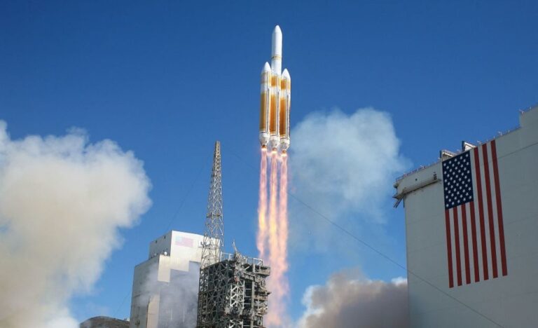
MATT HARTMAN/AFP via Getty Images
Five months after canceling a 15-year, $6.27 billion GPS ground-control program that never delivered operational capability, the U.S. Space Force unveiled its response at the Air & Space Forces Association’s Air, Space and Cyber Conference this week: a next-generation GPS architecture deliberately designed to be everything the failed program was not — commercially sourced, incrementally built, and grounded before it is launched.
Col. Neil Barnas, commander of Systems Delta 831 — the Space Systems Command unit responsible for Navigation Warfare and PNT acquisition — told reporters on September 15 at the Gaylord National Resort and Convention Center in National Harbor, Maryland, that the service will hold an industry day within weeks to formally begin planning for GPS Generation 4 (Gen4), the long-range successor to the current constellation. In the same remarks, he confirmed that follow-on contracts for the previously defunded Resilient GPS program (R-GPS) are set to be awarded shortly to three incumbent firms: Astranis, L3Harris Technologies, and Sierra Space.
The dual announcement — a near-term resilience stopgap and a multi-decade architectural overhaul — reflects a Space Force that has spent the past year absorbing hard lessons from the biggest software acquisition failure in GPS history.
What the OCX Failure Actually Cost
The GPS Next Generation Operational Control System, known as OCX, was designed to replace the two legacy GPS ground-control systems that have managed the constellation since the 1990s: the Architecture Evolution Plan (AEP), which commands and monitors the satellite fleet, and the Launch, Anomaly and Disposal Operations system. The Pentagon awarded the development contract to Raytheon (now RTX) in roughly 2010, with an original total program cost estimate of about $3.7 billion.
What followed was one of the most protracted software failures in U.S. defense history. By the time the Space Force formally accepted OCX from Raytheon in July 2025 following years of factory testing, the program had consumed $6.27 billion — nearly double its projected cost. Integrated systems testing against the full GPS enterprise, which connects OCX to actual satellites and user equipment simultaneously, then exposed problems across a broad range of capability areas. Mission Delta 31 Commander Col. Stephen Hobbs described the testing as revealing “insurmountable” integration problems that would put current military and civilian GPS capabilities at risk.
The Defense Acquisition Executive terminated the program April 17, 2026. RTX said in a statement that Raytheon had delivered the system and would continue to support post-delivery activities, but the Space Force’s verdict was unambiguous: OCX was unable to meet requirements on an operationally relevant timeline at an acceptable level of risk.
The episode has reshaped how the Space Force talks about GPS modernization. Acting service acquisition executive Tom Ainsworth, announcing the cancellation, called for acquisition processes favoring incremental delivery over complex “all or nothing” system deliveries. That framing — incremental over monolithic — is now the explicit design principle for Gen4.
A Phoenix Moment for Resilient GPS
The R-GPS revival is the more immediately consequential piece of news from Barnas’s September 15 briefing. The program was launched in 2024 under former Air Force Secretary Frank Kendall, who used Quick Start authority from Congress to award four quick-start design contracts — to Astranis, Axient (later acquired by Astrion), L3Harris Technologies, and Sierra Space — within six months, without waiting for the standard budget cycle.
The premise was straightforward: augment the existing 31-satellite GPS constellation in medium Earth orbit (MEO), located at approximately 20,180 kilometers (12,540 miles) altitude, with a proliferated fleet of smaller, cheaper satellites transmitting a core set of GPS signals. The first iteration — called “Lite Evolving Augmented Proliferation One,” or LEAP-1 — would put eight satellites in orbit by 2028, a pace that would make it one of the fastest GPS programs ever executed, compared with the GPS III program’s 10-year span from contract award to first launch.
The program hit turbulence quickly. The House Appropriations defense subcommittee questioned whether adding more GPS satellites — rather than pursuing alternative PNT concepts — was actually the best way to address jamming and spoofing threats, and funding for the next phase did not make it into the fiscal year 2026 budget. The program appeared dead.
Congress, however, provided a lifeline. With $15 million in congressional add-on funding, the service kept R-GPS alive, and Barnas told reporters the follow-on contracts will be awarded “shortly” to the three remaining vendors. Astrion — the company formed after Axient was acquired — had its contract discontinued by Space Systems Command after early design reviews revealed technical maturity issues.
The surviving vendors have already demonstrated meaningful progress. Astranis used flight-heritage software-defined radio (SDR) hardware and positioning, navigation, and timing algorithms from subcontractor Xona Space Systems to broadcast a GPS navigation signal and demonstrate signal acquisition and recovery of legacy navigation messages using an off-the-shelf GPS receiver — confirming that its R-GPS design complies with GPS specifications without requiring costly upgrades to existing user equipment. Sierra Space completed its own milestone, successfully demonstrating satellite-to-ground telemetry flow between its satellite ground software and a ground-station service provider using FlatSat flight software and hardware.
The focus for the follow-on contracts, Barnas said, will be what he described as “high-risk technologies associated with this future space segment” — specifically reprogrammable space-based cryptographic devices and new monitoring concepts. The SDR architecture enables exactly this: because the satellite’s signal-processing functions are implemented in software rather than fixed hardware, the cryptographic payload can be updated on orbit via software upload, reducing the risk of deploying a static system into a rapidly evolving threat environment.
Why Does Proliferating Satellites Help With Jamming?
Before accepting the R-GPS premise at face value, it is worth examining the technical debate that the House Appropriations subcommittee raised — because it goes to the heart of what GPS resilience actually means.
GPS signals at Earth’s surface are extremely weak, near noise floor. A low-cost transmitter broadcasting in the GPS L1 frequency band (1575.42 MHz) can drown out satellite signals across a significant area — what the military calls jamming. A more sophisticated attack, spoofing, involves broadcasting fake GPS signals that deceive a receiver into reporting a false position. Neither threat originates from space: both are generated near or at the user’s location.
Adding more satellites in MEO does not by itself make signals harder to jam at ground level. The House subcommittee’s criticism was specifically this: if the vulnerability is at the signal-reception layer, a proliferated MEO constellation addresses a different threat — kinetic attack on the constellation itself.
Against a kinetic threat, proliferation does change the calculus significantly. Current GPS relies on 31 large, expensive satellites that are difficult and slow to replace. More numerous, cheaper satellites are harder to hold at risk economically: an adversary must spend more to destroy them than the U.S. spent to build them. Space Force officials noted that early R-GPS satellite buses delivered higher power levels than the program of record — meaning the signals could be more resistant to jamming if the power advantage is large enough to overcome a ground-level jammer.
The answer the Space Force appears to be arriving at is that resilience requires both: proliferated constellations for kinetic survivability, and increasingly powerful and encrypted signals (M-code and its successors) for electronic survivability. GPS III and IIIF satellites already carry M-code, the military’s encrypted signal that uses Binary Offset Carrier modulation and can be transmitted at up to 20 decibels higher power via spot-beam directional antenna — providing meaningful jamming resistance in contested environments. Gen4 is expected to take this architecture further.
GPS Gen4: Ground First, Then the Stars
The longer strategic play is Gen4 itself, and its architecture reflects everything the Space Force learned from OCX’s failure.
The service launched the final two GPS III satellites earlier this year, completing a program that began in 2008, and is now moving through active GPS IIIF satellite production, which carries improved anti-jam capability and an upgraded civilian signal. Gen4 is the horizon beyond IIIF — and the Space Force is approaching it with deliberate caution.
The FY2027 budget requests $115 million for GPS Gen4, with $1.8 billion projected through fiscal 2031. Critically, the near-term funding is focused almost entirely on a new ground segment — not new satellites. The service is looking first to the commercial market for ground-segment technologies, conducting industry market research and exploring near-term options to tap commercial antenna manufacturers for the existing Gen3 ground architecture.
That commercial-first sequencing is a direct response to OCX. A monolithic, contractor-led ground-segment program that attempted to replace everything at once across a 15-year schedule produced a system that could not be integrated. The Gen4 approach — Barnas described the service as trying “to come at space-based PNT very holistically” — starts with commercially available building blocks and builds incrementally.
The Lockheed Martin awards that preceded this week’s conference underscore the parallel work already underway. On September 10, Lockheed Martin announced $114 million in Space Force task orders for GPS ground-segment modernization: a $96 million award to upgrade the current GPS ground system to operate GPS IIIF payloads, and a $17.5 million award to begin the first of three phases of a hardware and software technology refresh of the existing AEP under what the company calls AEP x86 Phase 1. These awards build on a separate Lockheed $105 million April 2026 contract for GPS IIIF launch, early-orbit, and disposal operations.
The scope of the full Gen4 vision extends beyond the ground. Barnas described an architecture that would include redundant ground infrastructure capable of withstanding targeted attacks, proliferated constellations distributed across multiple orbital regimes, and new protected signals for small drones and on-orbit sensors. The service is also exploring integration of allied systems — Europe’s Galileo and Japan’s Quasi-Zenith Satellite System (QZSS) — and the ingestion of space domain awareness data into the PNT enterprise.
A mid-2030s constellation augmentation, designated NM-4, is envisioned as a bridge to the full Gen4 system, with the complete architecture projected for delivery around 2040.
GPS: Infrastructure Too Big to Fail
The urgency behind all of this is what makes GPS unusual among national security programs: failure is not an option because GPS has long since become indistinguishable from civilian infrastructure. The 31-satellite constellation underpins banking, air traffic, and agriculture through financial transaction timing, cellular network synchronization, maritime navigation, and emergency dispatch systems.
Russia and China have both invested heavily in counter-space capabilities that could threaten the constellation, including directed-energy weapons and anti-satellite missiles. Adversarial jamming and spoofing have intensified across Ukraine, Baltic, Middle East conflict zones — and the military’s 31 large, expensive satellites in predictable orbits represent a concentrated and theoretically targetable asset.
The Gen4 logic is to eliminate that concentration: more satellites, multiple orbits, allied and commercial systems as backups, a ground segment that cannot be knocked out with a single attack on a single facility. Whether the architecture that emerges from the industry day Barnas announced will actually deliver on that vision — and whether it can navigate the political and budgetary gauntlet more successfully than OCX — is the central open question in American military space.
For now, the Space Force has at least demonstrated that it learned from the failure. The next question is whether learning is enough.
Frequently Asked Questions
What is the difference between GPS jamming and GPS spoofing — and does Resilient GPS actually fix either one?
Jamming floods the GPS frequency band with radio-frequency noise strong enough to drown out satellite signals at a receiver, effectively blinding it. Spoofing is more sophisticated: it broadcasts counterfeit GPS signals that a receiver accepts as genuine, causing it to report a false position. Both attacks occur near the user — not in space — so adding more GPS satellites in medium Earth orbit does not inherently make signals harder to jam or spoof on the ground. The House Appropriations subcommittee raised this exact objection. Where a proliferated Resilient GPS constellation does help is against the separate threat of kinetic attack on the satellites themselves: more, cheaper satellites are harder and more expensive for an adversary to destroy than a small fleet of large, expensive ones. The Space Force appears to be pursuing both tracks simultaneously — proliferated constellation for kinetic survivability, and stronger encrypted signals (M-code and successors) for electronic survivability.
Why was the OCX program canceled after 15 years and $6.27 billion?
The GPS Next Generation Operational Control System was intended to replace two legacy GPS ground-control programs with a unified modern system. Its fundamental failure was integration: the Space Force formally accepted the system from Raytheon in July 2025 after years of factory testing, then discovered during integrated systems testing — connecting OCX to actual operational satellites and user equipment simultaneously — that the software produced “extensive system issues” that were “insurmountable.” The problem was not that individual components failed, but that the assembled system could not operate within the broader GPS enterprise without putting current military and civilian GPS capabilities at risk. At $6.27 billion and nearly double its $3.7 billion original projection, OCX became a case study in what the Space Force’s own acquisition leadership now calls the dangers of “all or nothing” system deliveries.
What is GPS Generation 4, and when will it be ready?
GPS Generation 4 is the Space Force’s long-range plan for a fundamentally redesigned positioning, navigation, and timing architecture — not just new satellites, but a new ground segment, new protected signals for small drones and on-orbit sensors, potential integration of allied systems like Europe’s Galileo and Japan’s QZSS, and redundant infrastructure distributed across multiple orbital regimes. The Space Force will hold an industry day within weeks to begin formally defining the architecture, with $115 million requested in fiscal year 2027 and $1.8 billion projected through 2031. A mid-2030s bridge constellation (designated NM-4) is planned as an interim step. The full Gen4 architecture is projected for delivery around 2040 — which means anyone relying on GPS today will be using the current or IIIF generation for at least another 14 years.
Does GPS Generation 4 include allied satellite systems?
Yes, at least in concept. The Space Force is exploring integration of signals from Europe’s Galileo system and Japan’s Quasi-Zenith Satellite System into the broader Gen4 PNT enterprise, along with ingestion of space domain awareness data. The Space Force’s April 2026 Objective Force 2040 plan, announced at the Space Symposium, specifically called for augmenting future GPS with diverse allied and commercial navigation and timing systems, recognizing that GPS “can no longer operate as a standalone system in future conflicts.” Whether the legal, technical, and interoperability frameworks required to make allied GNSS integration operationally real will materialize before the 2040 target remains an open question.