HomeAuto One-Week Blackout Sparked Global Arms Race: 55 Nations Now Building Military Spy Satellites
One-Week Blackout Sparked Global Arms Race: 55 Nations Now Building Military Spy Satellites
September 16, 2026:
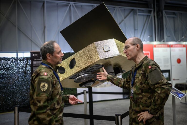
Igor IVANKO/AFP via Getty Images
Exactly eighteen months ago, Kyiv’s military commanders lost something they had taken for granted: eyes in the sky. For roughly a week in March 2025, the Trump administration suspended US intelligence sharing with Ukraine, and Maxar Technologies — acting on a directive from the US National Geospatial-Intelligence Agency — cut Ukrainian users off from the Global Enhanced GEOINT Delivery (GEGD) program, the primary portal through which Washington had shared commercial satellite imagery with Kyiv. The suspension lasted less than two weeks before being reversed following talks in Jeddah, Saudi Arabia, but the damage to allied confidence was permanent.
For defense ministries from Warsaw to Seoul, the lesson was direct, uncomfortable, and expensive: assured access to satellite-based intelligence cannot be borrowed indefinitely from a partner whose priorities can change with an election.
The bill for that lesson is now visible in the data. Speaking Tuesday at the Space Defense and Security Summit (SDSS) in Paris, Novaspace CEO Pacôme Révillon presented forecasts showing that defense-owned intelligence, surveillance, and reconnaissance (ISR) satellites to be launched between 2026 and 2035 will total 2,306 — up from just 485 in the previous decade. That is a nearly fivefold decade-on-decade increase, a pace without precedent in the history of military space.
“ISR is obviously a key priority currently for most nations,” Révillon told delegates at the summit. “It’s clearly a world that was already largely transparent, but the direction is as much for a diversification of assets for real-time and persistent intelligence.”
What Is a Military ISR Satellite — and Why Does It Matter That Nations Are Rushing to Build Their Own?
An ISR satellite is a platform for collecting intelligence about what is happening on Earth from orbit. The intelligence data these systems gather takes many forms — optical images, radar returns, electronic signals — but what matters to a military commander is the same thing that mattered to U-2 pilots in the Cold War: knowing where the enemy is, what they have, and what they are about to do.
Until recently, satellite-based ISR was an exclusive club. Building, launching, and operating the kinds of precision imaging satellites that deliver strategic intelligence required the resources of a superpower. The US, Russia, and China dominated the field, and allied nations largely relied on intelligence sharing rather than sovereign capability.
Two developments broke that model. The first was the commercial satellite revolution: companies such as ICEYE, a Finnish manufacturer, demonstrated that small satellites using synthetic aperture radar (SAR) technology could deliver strategic-grade imagery at a fraction of the cost of classified national systems. Unlike optical cameras, which require sunlight and clear skies, SAR satellites transmit microwave pulses that penetrate clouds, smoke, and complete darkness — providing all-weather, day-and-night imaging that was previously the exclusive domain of classified government programs. ICEYE’s satellites achieve 25-centimeter (9.8-inch) resolution — fine enough to identify individual vehicles on a battlefield.
The second development was the March 2025 GEGD suspension, which demonstrated that reliance on a single partner’s data architecture is a strategic vulnerability, not a strategic asset.
How Ukraine’s “People’s Satellite” Rewrote the Rules
The story of Ukraine’s space-based ISR capability begins not in a government procurement office but in a crowdfunding campaign. In mid-2022, the Serhiy Prytula Charitable Foundation raised approximately $16 million — originally intended for Bayraktar drones — and used it to purchase access to an ICEYE SAR satellite. Ukrainian military intelligence began receiving satellite imagery in late September 2022. By the time the GEGD suspension happened in March 2025, Ukraine had built up access to an entire constellation of ICEYE satellites and had taken more than 5,200 images of Russian military facilities, according to its Defense Intelligence directorate — 40 percent of which were used directly for targeting strikes.
The GEGD suspension revealed both how important that access had become and how fragile the American-supplied complement was. Ukraine’s US-provided imagery access was restored within days, but the episode sent an unmistakable signal: the GEGD program was a single point of control, and that control sat in Washington.
ICEYE CEO Rafal Modrzewski, announcing the Netherlands contract in June 2025, described the broader dynamic in plain terms. “This agreement is a step in European rearmament efforts for securing the defense of European nations,” he said, with the Netherlands becoming the first country to field an operational military satellite mission through the ICEYE platform. The contract covered four SAR satellites with 25-centimeter (9.8-inch) resolution — identical to the capability Ukraine had crowdfunded in 2022 — plus a local ground segment and access to ICEYE’s existing constellation.
Last week at the MSPO defense show in Kielce, Poland, Prime Minister Donald Tusk announced that ICEYE and Poland’s state-run defense conglomerate PGZ had signed a letter of intent to jointly develop a military satellite communications system. Tusk framed the ambition explicitly: “The culmination of the process that began today can and will be a Polish Starlink,” he said, referencing SpaceX’s constellation as the benchmark. The program runs from 2026 to 2030.
Constellations Replace Single Satellites — and the Architecture Change Is Deliberate
The nearly fivefold increase in ISR satellite launches is not simply more of the same. It represents a fundamental architectural shift in how military space capability is built and protected.
The model that dominated military space from the Cold War through the early 2020s favored a small number of large, expensive, highly capable satellites in high orbits — often geostationary orbit (GEO) at 35,786 kilometers (22,236 miles) above Earth. A single such satellite could cost $500 million to $1 billion or more. Losing one to a technical failure or hostile action meant losing years of capability.
The model now gaining dominance places many smaller, cheaper satellites in low Earth orbit (LEO) — typically between 160 and 2,000 kilometers (99 and 1,243 miles) above Earth. SpaceX’s Starlink constellation proved that thousands of small LEO satellites could be built and launched economically. The US Space Development Agency has pushed this architecture into defense procurement. The result is a resilient distributed system: a hostile actor who destroys one node has degraded the constellation’s capacity by a fraction rather than eliminated a program.
This is why Novaspace’s data shows the majority of the coming wave of ISR satellites will be elements of constellations rather than single platforms — and it is why even relatively small nations, with defense budgets that could never have sustained a Cold War-era reconnaissance satellite program, can now contemplate fielding sovereign space-based ISR.
Defense Space Budgets Are Doubling — in Three Years
The ISR surge is unfolding against a backdrop of rapid expansion in overall government defense space investment. According to Novaspace’s 25th Government Space Programs report — the authoritative annual survey of global space spending — defense accounted for 54% of total global government space spending in 2025, or approximately $73.5 billion out of $137.4 billion in total investment. That figure marks the first time defense has outpaced civil spending in absolute dollar terms, cementing what the report describes as space’s role as “a core national security domain alongside land, air, maritime, cyber, and information.”
At least 55 countries now have dedicated space defense budgets. A generation ago, that number was effectively two — the United States and the Soviet Union.
Novaspace projects defense space budgets will climb toward $121 billion by 2028, driven by several converging forces: the lessons Ukraine’s war has taught about battlefield ISR; the Golden Dome early-warning architecture under development in the United States; European nations’ post-2022 defense spending increases; and the EU Commission’s proposed EUR 131 billion ($145 billion, approximately, at current exchange rates) combined defense, security, and space envelope for 2028–2034, announced at Paris’s International Space Summit in September 2026.
Space Has Become a Warfighting Domain — and the US Is Acting Like It
What the March 2025 GEGD suspension also revealed, beyond Ukraine’s vulnerability, was that space-based intelligence is now understood at the highest levels of US national security as a warfighting resource that can be rationed like any other. That realization has accelerated American investment in offensive as well as defensive space capabilities.
In August 2026, US Space Command Gen. Stephen Whiting made an explicit call for integrated space fires — a term of art that includes kinetic options, meaning weapons that could physically damage or destroy adversary satellites in orbit. Earlier this year, the US Space Force published its Future Operating Environment 2040 doctrine document, describing a space domain with lower thresholds for kinetic attack. Space Force leadership has previously indicated that a substantial classified on-orbit capability for “full-spectrum operations” became operational in 2026.
That trajectory — more ISR satellites, more weapons in orbit, more nations competing in a domain that was once a superpower duopoly — is precisely why space situational awareness is emerging as its own massive investment category.
An Orbital Traffic Problem That Doesn’t Have a Simple Solution
Novaspace estimates there are currently approximately 18,000 active satellites in orbit. By 2036, that number could reach between 50,000 and 100,000 — a potential fivefold increase at the midpoint of that range, driven by the combination of commercial mega-constellations (SpaceX Starlink, Amazon Kuiper, China’s Qianfan and Guowang networks) and the coming wave of proliferated military ISR platforms.
Space situational awareness — the ability to track, catalog, and predict the behavior of every object in orbit — is consequently becoming a strategic priority in its own right. Novaspace projects $61 billion in SSA investment between 2025 and 2034, with defense programs accounting for $52 billion of that total. More than 400 dedicated SSA satellites are expected to be launched in the same window, with Space Surveillance and Tracking spacecraft accounting for roughly half.
“SSA is no longer just about tracking objects — it has become a strategic capability underpinning national security, operational decision-making, and the safe use of increasingly congested orbital environments,” Novaspace analyst Hugo Kalifa wrote in a separate report released earlier this year.
In a contested orbital environment, SSA is also an intelligence function: knowing where an adversary’s satellites are, detecting when they maneuver, and determining whether an anomalous orbit change represents a technical failure or a hostile repositioning. That is a mission that requires not just tracking capability but interpretation — and interpretation requires the kind of high-quality SSA coverage that only a handful of nations can currently provide at global scale.
What Does This Mean for Nations That Want Sovereignty but Cannot Afford the Full Stack?
The political logic of the post-2025 sovereignty push is straightforward: if Ukraine had been entirely dependent on US imagery for battlefield ISR, the March 2025 suspension would have been catastrophic rather than inconvenient. The commercial satellite ecosystem — ICEYE in particular — provided an alternative that partially offset the American data withdrawal.
But sovereignty is expensive, and the architecture it requires is more complex than simply buying a satellite. A sovereign ISR capability requires a full stack: the satellites themselves, the ground segment for downlink and tasking, the exploitation infrastructure to turn raw radar or optical data into actionable intelligence, and the secure communications links to deliver that intelligence to commanders. For mid-tier allies, each of these elements represents a gap.
The Poland/ICEYE/PGZ partnership announced last week is a model for how that gap might be closed — by combining a Finnish technology partner with existing commercial SAR expertise and a domestic defense industrial base capable of developing and maintaining the system independently. The program explicitly aims to build Polish industrial capability, not just to procure a product.
Novaspace serves as the primary market intelligence authority for the space sector, working with more than 1,200 clients in 60 countries from 10 global offices. The forecasts Révillon presented Tuesday at the SDSS will reverberate through defense procurement offices for months.
The bottom line from Paris is stark: the next decade will see more military satellites launched than in the entire history of the space age combined, a space situational awareness challenge of unprecedented scale, and a defense budget trajectory that will reshape the economics of the industry entirely. But beneath the headline numbers lies a more complex dynamic: the very rush to build sovereign ISR capability is filling an orbit that no single nation can monitor alone — creating a new form of interdependence that the sovereignty push was partly designed to escape.
Currency conversions in this article are approximate, based on exchange rates at the time of publication and subject to change.
Frequently Asked Questions
What exactly happened when the US cut Ukraine off from satellite imagery in March 2025?
On March 7, 2025, the US National Geospatial-Intelligence Agency directed Maxar Technologies to suspend Ukrainian users’ access to the Global Enhanced GEOINT Delivery (GEGD) program, the US government platform for sharing commercially tasked satellite imagery with allies. The suspension followed the Trump administration’s broader freeze on intelligence sharing with Kyiv, intended to pressure Ukrainian President Zelenskyy into peace negotiations. Access was restored on or around March 11–12, 2025, following US-Ukrainian negotiations in Jeddah, Saudi Arabia. The episode demonstrated that Ukraine’s access to US-provided imagery was contractually contingent on continued US government authorization — a single point of control that allied nations interpreted as a sovereignty vulnerability.
What is a SAR satellite, and why is it better than a regular camera in space?
Synthetic aperture radar (SAR) is a sensor technology that transmits microwave pulses toward Earth and records the reflected energy. Because microwaves penetrate clouds, smoke, and darkness, a SAR satellite can produce high-resolution images regardless of weather or time of day — capabilities that conventional optical satellites, which depend on sunlight and clear skies, cannot match. ICEYE’s SAR satellites achieve 25-centimeter (9.8-inch) resolution — fine enough to identify individual military vehicles. Ukraine’s use of commercial SAR imagery during its war with Russia demonstrated that small, commercially operated SAR satellites can deliver intelligence that previously required multibillion-dollar classified government programs.
Why are countries building their own military satellite systems instead of just buying imagery from commercial providers?
Commercial imagery from companies like ICEYE, Planet, and Maxar can be purchased — but it can also be switched off. The March 2025 GEGD suspension showed that even commercially operated imagery accessed through US government contracts is subject to US policy decisions. Nations that want assured, uninterrupted access to ISR data need sovereign systems they control and that no foreign government can suspend. Sovereignty also matters for the most sensitive intelligence tasks — targeting data, signals intelligence, and the tracking of classified adversary capabilities — where nations are unwilling to depend on commercial providers or allied data pipelines.
Does the satellite sovereignty race solve the problem — or create a new one?
The rush to build sovereign ISR capability is filling Earth orbit faster than the infrastructure to manage it can scale. Novaspace estimates there are currently around 18,000 active satellites in orbit; that number could reach 50,000 to 100,000 by 2036. Tracking, cataloging, and predicting the behavior of that many objects — to avoid collisions and to detect hostile maneuvers — requires space situational awareness (SSA) infrastructure that no single nation can fully maintain alone. The projected $61 billion in SSA investment between 2025 and 2034 reflects this: nations are simultaneously building the orbital congestion that makes SSA more difficult and spending heavily to develop the SSA capability that congestion demands. For smaller nations that cannot afford the full SSA stack, a new form of strategic dependence — on others’ orbital tracking data — may simply be replacing the dependence on US imagery that the sovereignty push was designed to escape.